María Jesús, naturista del Portús. Viñeta 85

mariajesus85-gd

– Auntie, we’re studying world religions at school.
– Interesting!
– Do you know if the “fauna” that comes to El Portús is religious?
– What?
– I say it for this Amish turtle, it sure comes from the United States.
– Amish? I’d like to catch the one who throws the masks.

Publicado en MARÍA JESÚS | Deja un comentario

María Jesús, naturista del Portús. Viñeta 84

mariajesus84-gd

– Congratulations for your exam, Pablito. Did you have a good Holiday?
– Yes.
– And did you miss them?
– No.
– Here we are my friend, working online myself and online lessons for my son.
– I see, what suffering in El Portús!

Publicado en MARÍA JESÚS | Deja un comentario

María Jesús, naturista del Portús. Viñeta 83

mariajesus83-gd– There are no parasols on the campsite’s beach.
– Well, no.
– The campsite has asked customers not to reserve beach areas with their parasols out of solidarity … They can limit distances and therefore increase the health risk.
– And so?
– An imported case. The East wind is already beginning in Cabo de Palos.

Publicado en MARÍA JESÚS | Deja un comentario

María Jesús, naturista del Portús. Viñeta 82

mariajesus82-gd

– Hello, María Jesús!
– What a joy to see you at the campsite again!
– Michael!!!
– And the girl? Without a mask on?
– Oh, my friend! You don’t know what it costs us!

– There is nothing that love cannot overcome.

Publicado en MARÍA JESÚS | Deja un comentario

Galifa, un paraíso por descubrir

A unos 9 km al oeste de la ciudad de Cartagena, a cuyo término municipal pertenece, se encuentra la población de Galifa en la carretera que conduce a El Portús dentro de la diputación de Perín

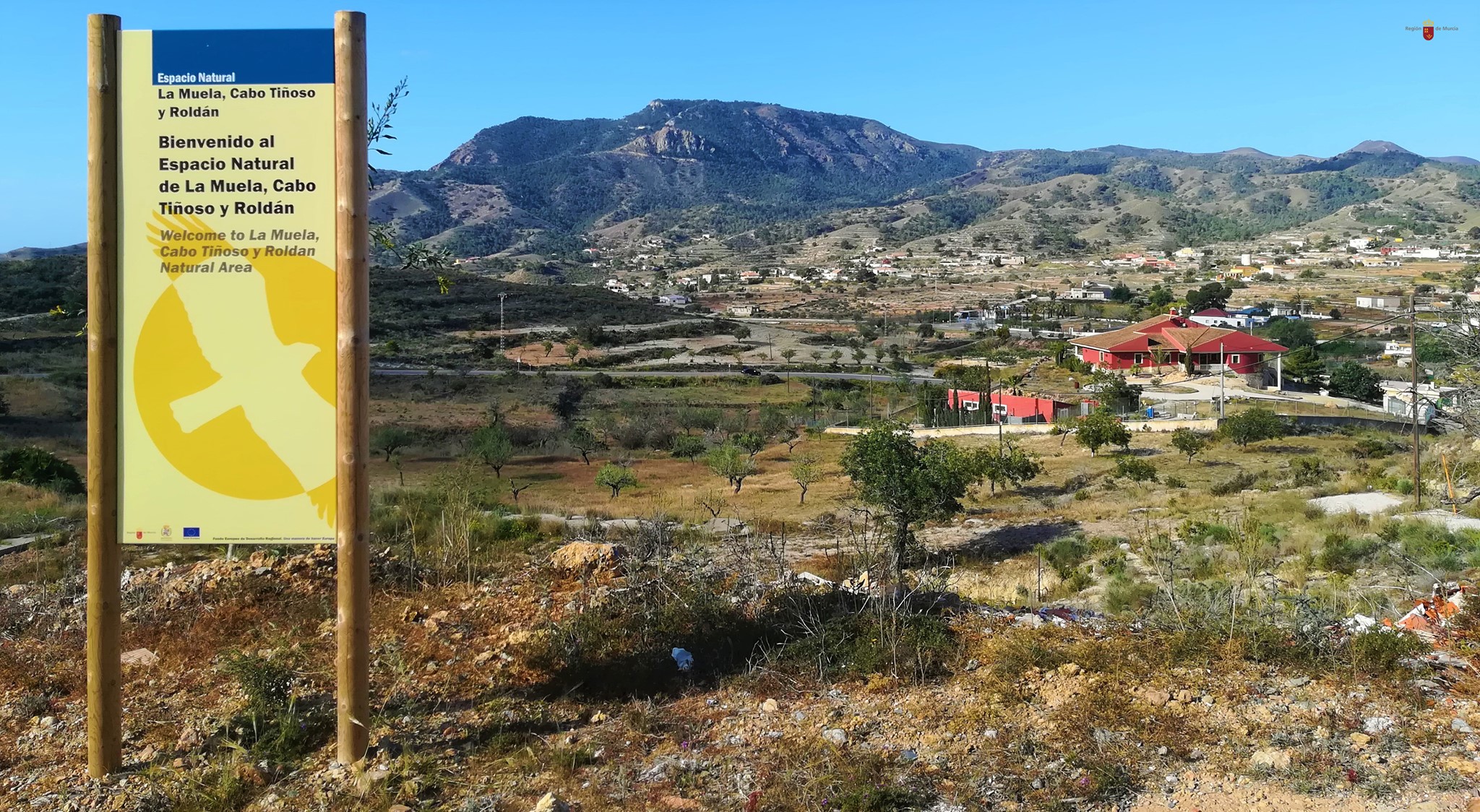
El pueblo se encuentra dentro del Parque Natural de la Sierra de la Muela, Cabo Tiñoso y Roldán, un espacio protegido de gran valor ecológico.

galifa

Según el censo municipal de 2008 la población de Galifa ascendía a 247 habitantes, de los cuales 25 eran extranjeros.

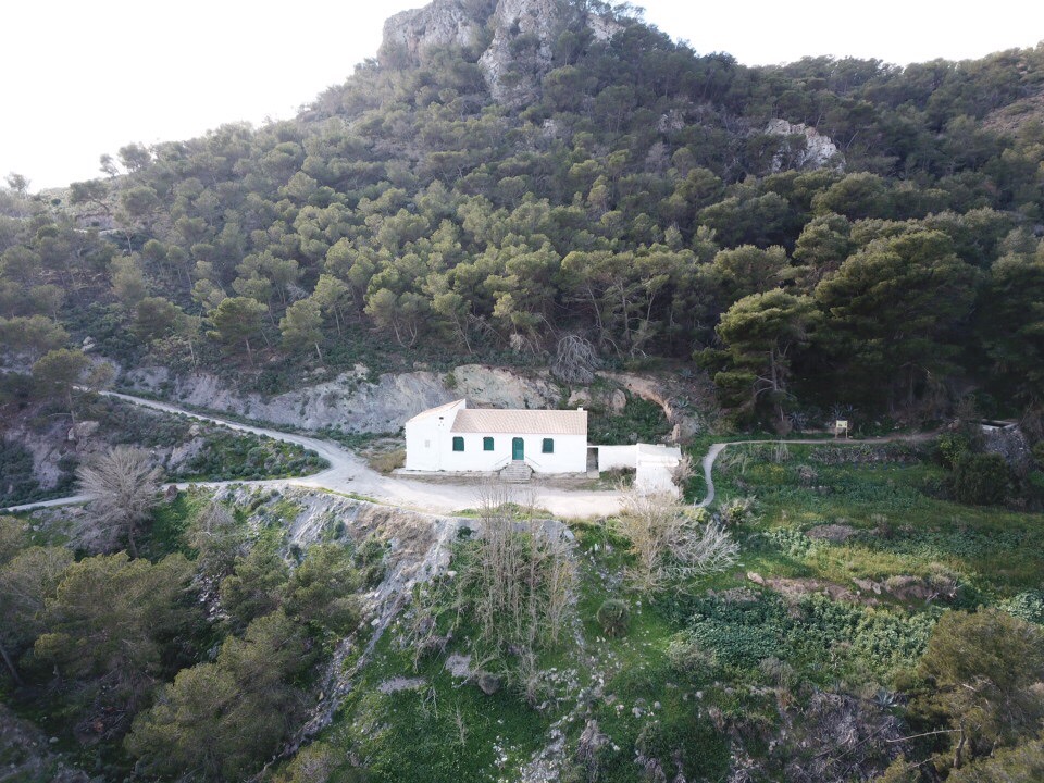
Las fiestas populares de Galifa se celebran del 29 de junio al 16 de julio, fecha esta última en la que se celebra la festividad de la Virgen del Carmen en la cual se celebra una romería en la que trasladan la imagen de la Virgen a su ermita, construida en 1879 y en la que celebra misa todos los domingos. Es una sencilla edificación de planta baja rectangular con una nave principal, tejado a doble vertiente, fachada sencilla con acceso de arco de medio punto y con dos hornacinas donde están las imágenes de San Rafael y San Enrique.


ermita la muela

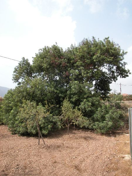
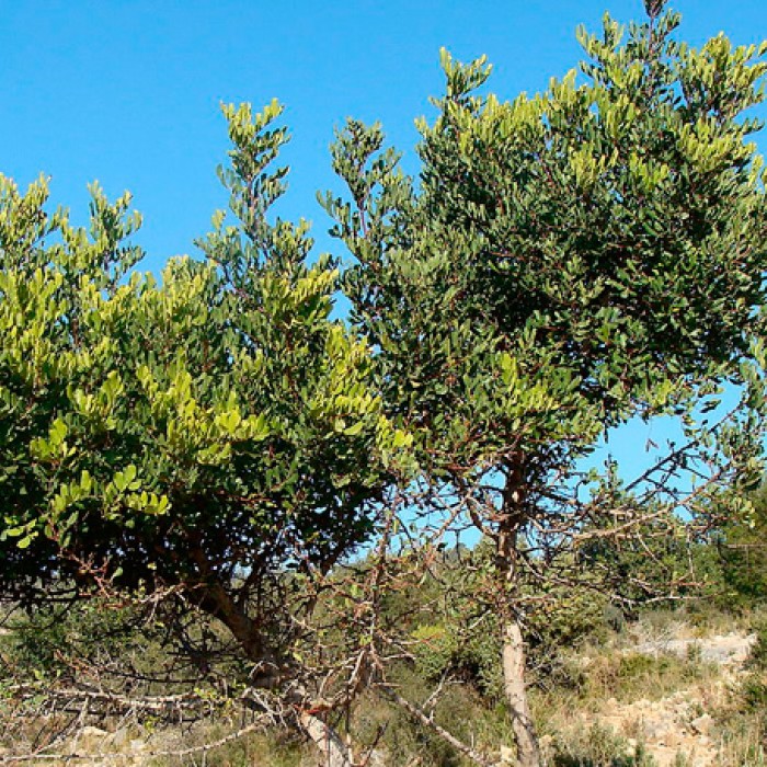
En este lindo pueblo de nuestro campo, situado a mitad de camino de la carretera que lleva hasta nuestra playa de El Portús, podemos encontrar un árbol muy especial: el Garrofero. Es un algarrobo conocido como el Algarrobo de Galifa, que, no es el de mayor tronco de la Región pero sí uno de los más notables. Está muy bien conservado y es el de mayor envergadura. Tiene más de 500 años y cuenta con siete largas ramas, que se apoyan directamente en el suelo.  Es uno de los algarrobos más antiguos y de mayores dimensiones de la Región de Murcia. Alcanza los 11 metros de altura y los 5,75 metros de cuerda. Muy cerca de este ejemplar único se encuentra otro algarrobo de 4,40 metros de perímetro y cerca de Galifa hay más algarrobos centenarios.

GARROFERO


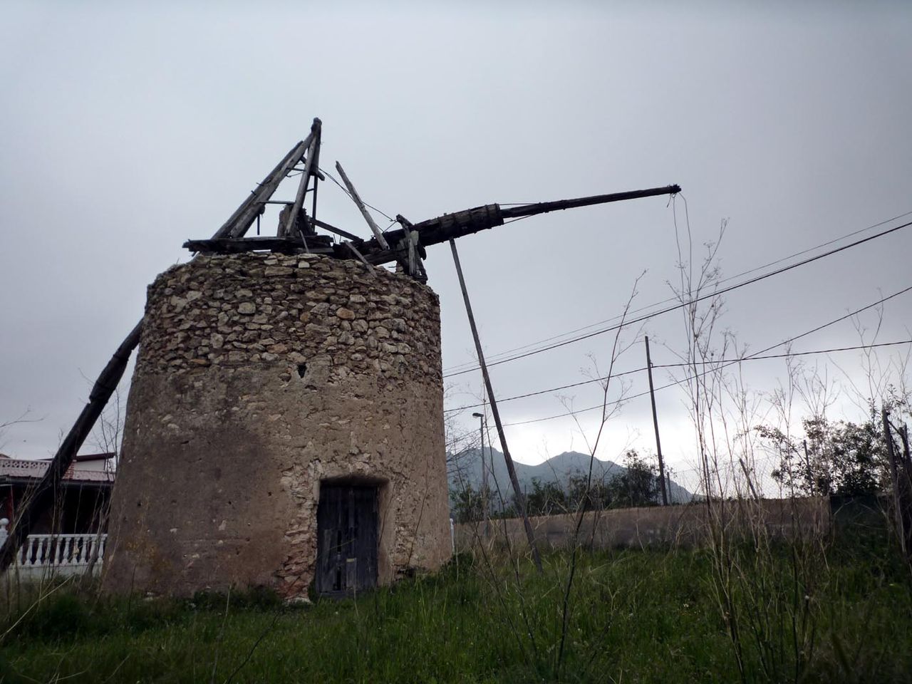
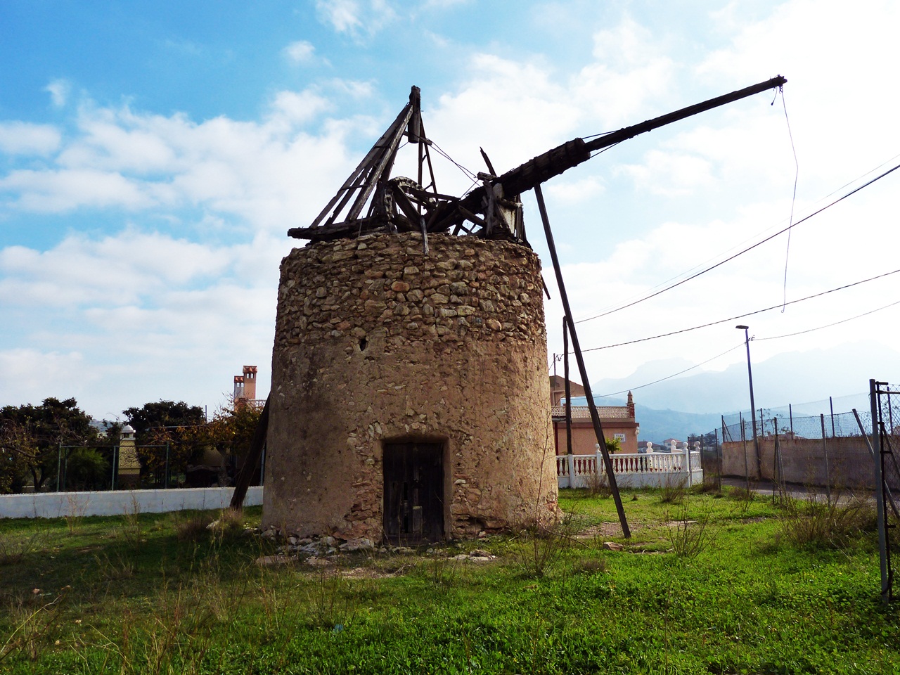
En esta misma carretera de la Playa del Portús, en el caserío de Galifa, hay un magnífico molino de viento, hoy en ruinas, pero que aún conserva una bella estampa digan de ser fotografiada mientras se disfruta pensando en lo que en su día fue.

Molino de viento en ruinas en Galifa

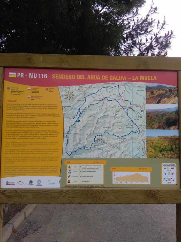
SENDERO DE GALIFA, RUTA DEL AGUA

Dar a conocer estas zonas de gran belleza y valor ambiental contribuye a conservar, mantener y poner en valor los recursos naturales y paisajísticos del territorio.

En el recorrido Sendero del Agua de Galifa podemos disfrutar del maravilloso entorno por el que transcurre y el rico patrimonio que atesora: molinos de viento, árboles monumentales, canalizaciones y galerías, así como construcciones tradicionales del Campo de Cartagena. Es también una oportunidad para descubrir los valores de la Sierra de la Muela como Espacio Natural.

CARTEL TRAIL

cartel sendero del agua

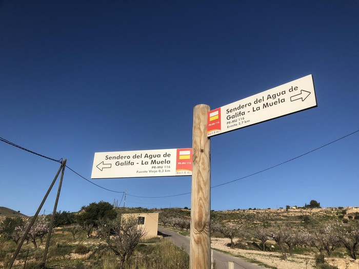
El  ¨Sendero del Agua de Galifa ¨permite conocer las infraestructuras que diferentes compañias de agua construyeron durante el siglo XIX y hasta mitad del siglo XX para abastecer a la ciudad de Cartagena.

sendero del agua

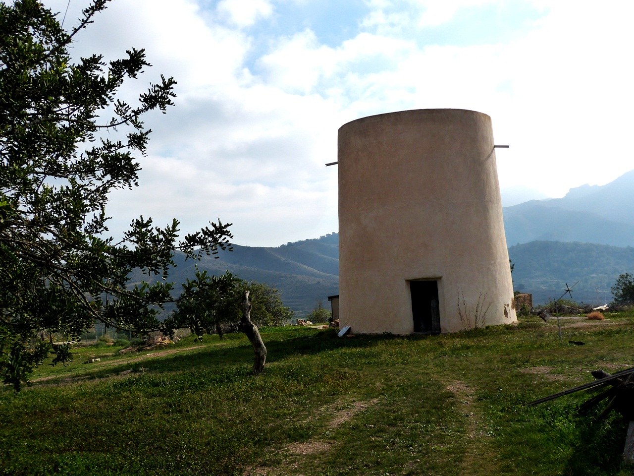
Al inicio del sendero se encuentra la ermita de Galifa, y los molinos de viento del tío Lázaro y del tío Ginés.

molino tio Lázaro

molino tio Ginés

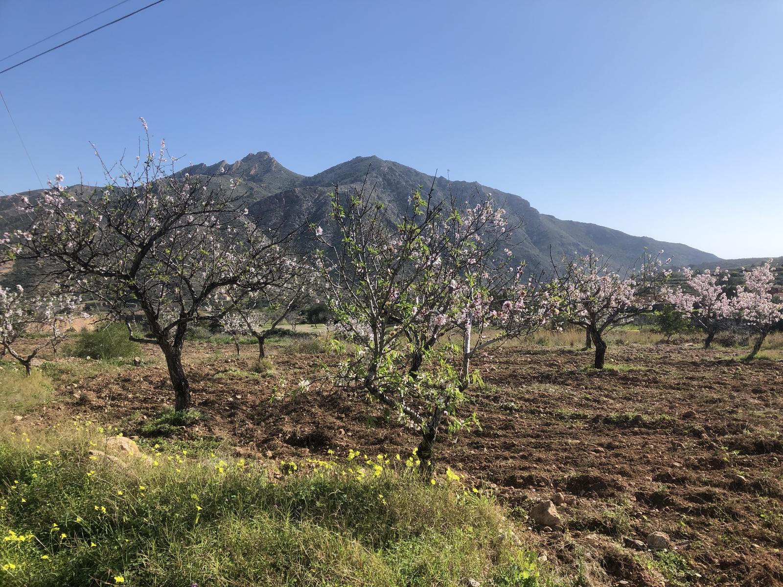
El sendero PR-116 se adentra en el paisaje agrario de Galifa, mostrando cultivos tradicionales de algarrobo y almendro en secano.

almendros

A 3 km del inicio del sendero, se encuentra el depósito del Bancal Blanco, con una capacidad de 6000 m³ que pertenece al sistema de recogidas de agua de Fuente Vieja  ¨gestionado por la Compañia Inglesa de aguas».

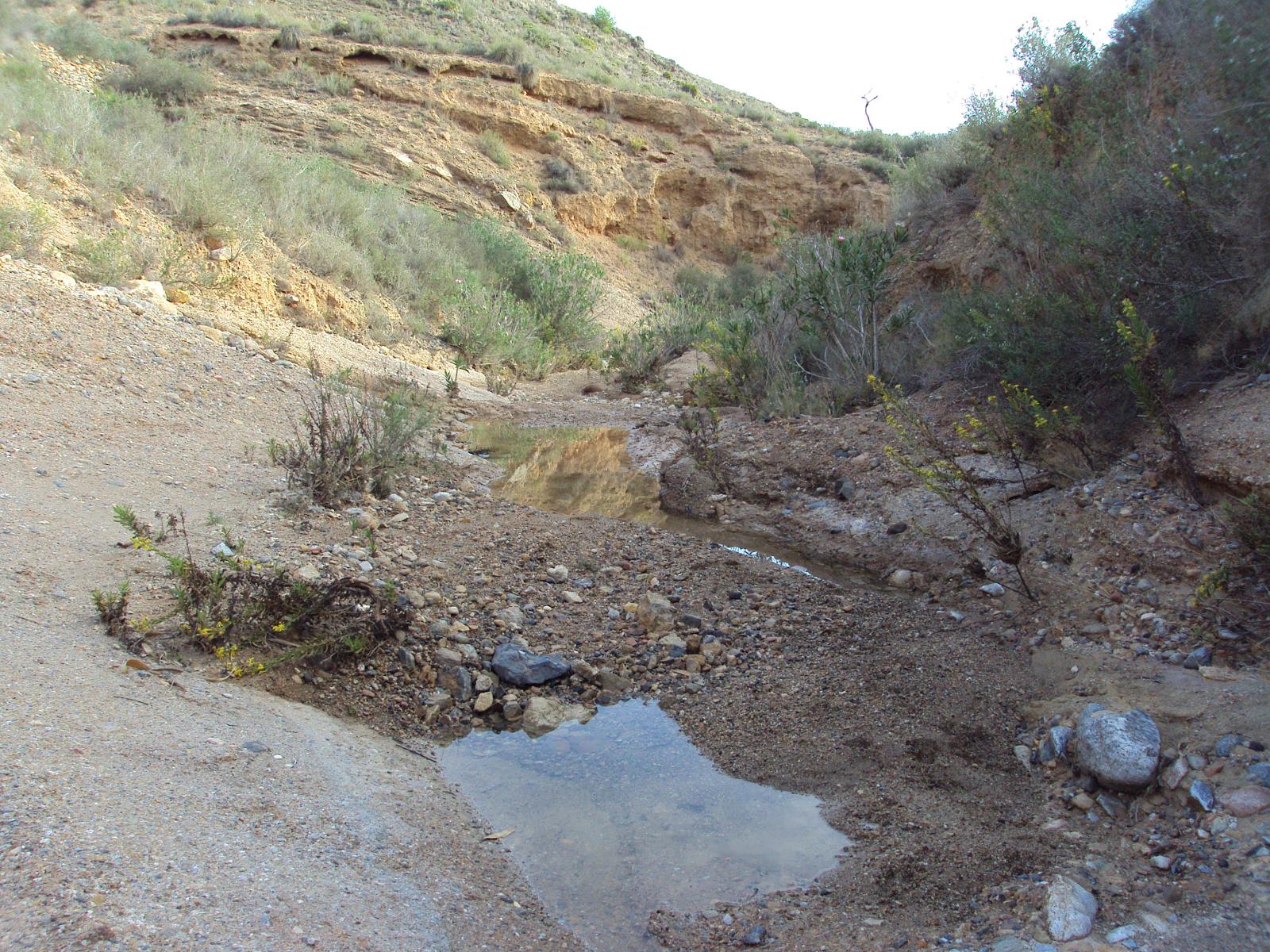
El manatial de Fuente Vieja es un pequeño salto de agua originado por la rambla del Cabezo Negro, cuyas fuentes canalizadas fueron aprovechadas para el consumo de la ciudad de Cartagena antes de la llegada del canal del Taibilla.

RAMBLA CABEZO NEGRO

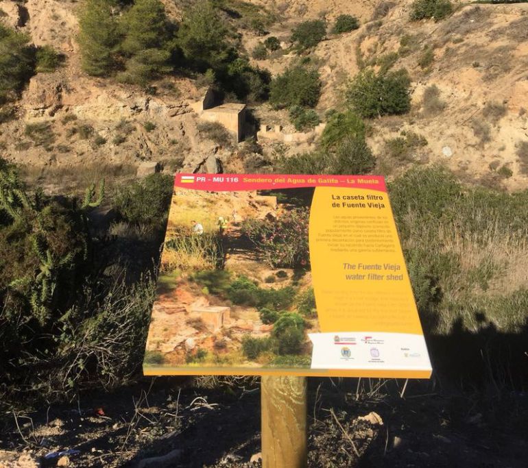
En Fuente Vieja se encuentra la caseta filtro. Es un pequeño depósito, donde confluyen las aguas para su decantación y posterior conducción al depósito del Bancal Blanco.

CASETA FLITRO

Aguas arriba de la caseta filtro, en la Rambla del Cabezo Negro, se pueden encontrar 3 azudes, con la función de reducir la erosión del agua.

Continuando el recorrido del sendero, se llega al Depósito de la Manda, que tenía la función de regulación del sistema de Fuente Vieja con una capacidad de 8000 m³ de agua abasteciéndose del depósito Giménez.

Más arriba, se encuentra el Depósito de Giménez, que recibía las aguas a través de un canal que conecta con un azud ubicado en la Rambla del Cabezo Negro.

La Compañía de los Cartageneros, dispuso de un sistema de pozos mediante vasos comunicantes conectados con una galería a 110 metros.

Así se transportaba el agua desde Rambla de Giménez a la Rambla del Cabezo Negro.

Enclavados entre pinares, el sistema de Fuente Vieja, dispone de 2 ¨depósitos enanos¨usados por la Compañía Inglesa para los viveros de producción de planta forestal que dieron lugar a los » Pinares del Inglés ¨.

Los caudales sobrantes del depósito enano de Rambla Giménez, se conducían a la cuenca del Cabezo Negro mediante un canal abierto y un túnel que atraviesa la divisoria entre cuencas.

El sendero transcurre por el Parque Regional Sierra de la Muela, Cabo Tiñoso y Roldán, donde viven aves como el Águila perdicera, Águila real, Halcón peregrino o el Búho Real.

Los pequeños núcleos rurales configuran el territorio de este lugar, en cuyo paisaje destacan los bancales con pedrizas que caracterizan la agricultura tradicional de Galifa.

Para aquellos que prefieran hacer turismo de naturaleza a caballo, el Club Hípico Sierra de la Muela ofrece recorridos para conocer los más singulares rincones.

Al finalizar el recorrido,  se puede disfrutar de la gastronomía local en el Restaurante Casa Ramírez.

En dirección a Cartagena, junto a la carretera se encuentra el garrofero de Galifa, que es un árbol monumental e histórico.

En las proximidades de este árbol se encuentra  la Venta de la Muela y una noria de sangre.

Galifa mantiene la música tradicional, celebrando en Navidad el encuentro de cuadrillas de cante de Pascua.

También en esta época, es de interés visitar el Belén artesanal de los Díaz.

Un recorrido por la cultura del agua, la flora, la fauna, los paisajes litorales, la gastronomía y las tradiciones, esperan al visitante

GALIFA

About 9 km west of the city of Cartagena, to whose municipal term it belongs, is the town of Galifa on the road that leads to El Portús within the Perín deputation.

The town is located within the Sierra de la Muela, Cabo Tiñoso and Roldán Natural Park, a protected area of great ecological value.

According to the 2008 municipal census, the population of Galifa was 247 inhabitants, of which 25 were foreigners.

Galifa’s popular festivities are held from June 29 to July 16, the latter date when the Virgen del Carmen festival is celebrated, in which a pilgrimage is held in which the image of the Virgin is transferred to her hermitage , built in 1879 and in which he celebrates mass every Sunday. It is a simple rectangular ground floor building with a main nave, a double-sided roof, a simple façade with access to a semicircular arch and two niches with the images of San Rafael and San Enrique.

In this beautiful town in our countryside, located halfway along the road that leads to our El Portús beach, we can find a very special tree: the Garrofero. It is a carob tree known as the Galifa Algarrobo, which is not the largest trunk in the Region but is one of the most notable. It is very well preserved and is the largest. It is more than 500 years old and has seven long branches, which rest directly on the ground. It is one of the oldest and largest carob trees in the Region of Murcia. It reaches 11 meters in height and 5.75 meters of rope. Very close to this unique specimen is another carob tree with a 4.40 meter perimeter and near Galifa there are more centenary carob trees.

On this same road to Playa del Portús, in the Galifa farmhouse, there is a magnificent windmill, now in ruins, but which still retains a beautiful image, worthy of being photographed while enjoying yourself thinking about what it once was.

GALIFA TRAIL, WATER ROUTE

Publicizing these areas of great beauty and environmental value helps to conserve, maintain and value the natural and landscape resources of the territory.

On the Galifa Water Trail tour we can enjoy the wonderful environment through which it runs and the rich heritage it treasures: windmills, monumental trees, pipes and galleries, as well as traditional constructions of the Campo de Cartagena. It is also an opportunity to discover the values of the Sierra de la Muela as a Natural Space.

The ¨Galifa Water Trail¨ allows to know the infrastructures that different water companies built during the 19th century and until the middle of the 20th century to supply the city of Cartagena.

At the beginning of the trail is the hermitage of Galifa, and the windmills of Uncle Lázaro and Uncle Ginés.

The PR-116 trail enters the agricultural landscape of Galifa, showing traditional carob and almond crops in dry land.

3 km from the trailhead, there is the Bancal Blanco reservoir, with a capacity of 6000 m³ that belongs to the Fuente Vieja water collection system «managed by the English Water Company».

The Fuente Vieja spring is a small waterfall originated by the rambla del Cabezo Negro, whose channeled sources were used for the consumption of the city of Cartagena before the arrival of the Taibilla canal.

In Fuente Vieja is the filter house. It is a small deposit, where the waters converge for its decantation and subsequent conduction to the Bancal Blanco deposit.

Upstream of the filter house, on the Rambla del Cabezo Negro, 3 weirs can be found, with the function of reducing water erosion.

Continuing along the path, you reach the Manda Deposit, which had the function of regulating the Fuente Vieja system with a capacity of 8000 m³ of water supplying the Giménez deposit.

Higher up is the Giménez Deposit, which used to receive the waters through a channel that connects to a weir located on the Rambla del Cabezo Negro.

The Cartageneros Company had a system of wells by means of communicating vessels connected to a gallery 110 meters away.

Thus, the water was transported from Rambla de Giménez to the Rambla del Cabezo Negro.

Nestled among pine forests, the Fuente Vieja system has 2 «dwarf tanks» used by the English Company for the forest plant production nurseries that gave rise to the «Pinares del Inglés».

The excess flows of the dwarf deposit of Rambla Giménez, were conducted to the Cabezo Negro basin through an open channel and a tunnel that crosses the divide between basins.

The trail runs through the Sierra de la Muela, Cabo Tiñoso and Roldán Regional Park, where birds such as Bonelli’s Eagle, Golden Eagle, Peregrine Falcon or Eagle Owl live.

The small rural towns make up the territory of this place, in whose landscape the terraces with stones that characterize Galifa’s traditional agriculture stand out.

For those who prefer to do nature tourism on horseback, the Club Hípico Sierra de la Muela offers tours to discover the most unique corners.

At the end of the tour, you can enjoy the local gastronomy at the Casa Ramírez Restaurant.

In the direction of Cartagena, next to the road is the Galifa stew, which is a monumental and historical tree.

In the vicinity of this tree is the Venta de la Muela and a blood wheel.

Galifa maintains traditional music, celebrating the gathering of Easter cante crews at Christmas.

Also at this time, it is interesting to visit the Artisan Nativity Scene of the Díaz.

A tour of the water culture, flora, fauna, coastal landscapes, gastronomy and traditions await the visitor.

Publicado en CURIOSIDADES / CURIOSITIES | 2 comentarios

María Jesús, naturista del Portús. Viñeta 81

mariajesus81-gd

 “Ever since May, with The State of Alarm due to the Coronavirus pandemic; some regions, such as Murcia, have been allowed to move around and lodge clients in campsites.  But only within their own Region.  So during the last few weeks the only customers who could come to the campsite were Murcian. And many of them have that peculiar and friendly way of speaking that, sometimes, the rest of the Spanish do not understand … «

Publicado en MARÍA JESÚS | Deja un comentario

María Jesús, naturista del Portús. Viñeta 80

mariajesus80-gd

– Hi María Jesús! How is everything going in your city?
– Hi Aurelio! Good, but I am missing ‘El Portús’.
– Here, everyone is being very disciplined during the de-escalation
– I’m sunbathing on the balcony with my mask and everything.
– Maria Jesus! Health does not obligate you!
– No, but my neighbour, the «voyeur», does.

Publicado en MARÍA JESÚS | 2 comentarios

DISFRUTA DEL ENTORNO QUE TE RODEA

En este segundo capítulo dedicado a nuestro entorno más cercano os proponemos una serie de rutas para los amantes de la montaña y del mar, una manera muy sana para salir de la rutina volviendo a los orígenes del ser humano, disfrutando de la naturaleza con todo lo que nos ofrece, siendo conscientes de la necesidad de una óptima adaptación al medio.

Os proponemos una visita al monte Roldán, una ruta a la Sierra de la Muela e intensificar así la sensación de monte y un atractivo paseo en piragua por nuestros alrededores visitando La Cueva del Gigante, playa Fatares y la Isla de las Palomas.

SENDERO MONTE ROLDÁN

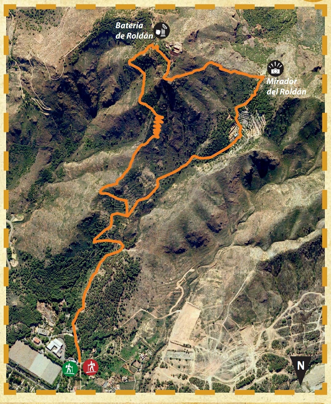
La subida al Monte Roldán, en el Espacio Natural de la Sierra de La Muela, Cabo Tiñoso y Roldán, nos ofrece, a 490 metros sobre el nivel del mar, impresionantes vistas del litoral cartagenero. Durante el recorrido se puede disfrutar de un entorno natural de alto valor ecológico y visitar en su cumbre la batería de Roldán, declarada Bien de Interés Cultural.

  • Tipo: Circular
  • Distancia: 5,7 km
  • Tiempo estimado: 2 h y 30 min.
  • Dificultad: Media
  • Desnivel: 450 m
  • Inicio y final: aparcamiento junto a la instalación de los canales del Taibilla.
mapa roldan

leyenda

Para saber un poco más…

«Cuando el Roldán tiene montera llueve en Cartagena quiera Dios o no quiera» (Dicho popular ) 

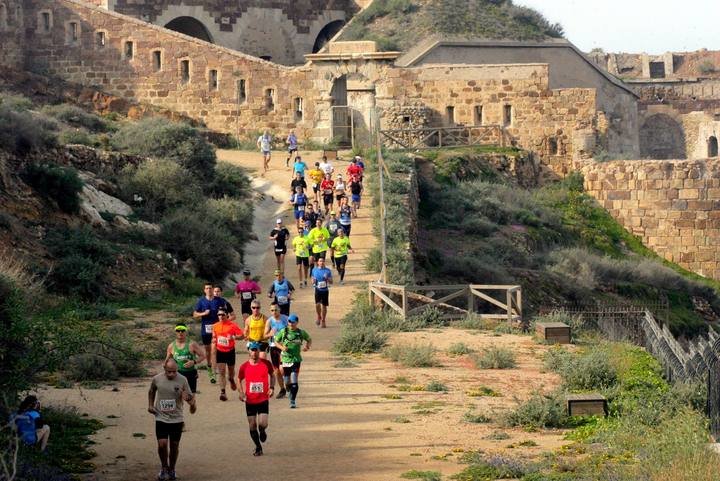
El Monte Roldán, por su cercanía a la ciudad de Cartagena y su atractivo paisaje, es muy frecuentado para la práctica de senderismo, ciclismo, carreras por montaña y todo tipo de actividades recreativas. Asimismo, es el escenario de importantes eventos deportivos como la carrera “Ruta de las Fortalezas”.
RUTA FORTALEZA 2

Este intenso uso del espacio provoca impacto en el medio como son:

  • Erosión del terreno.
  • Pérdida de vegetación por la proliferación de atajos.
  • Abandono de basura.
  • Molestias a la fauna.

otro camino roldan

Para seguir disfrutando de los privilegios que nos ofrece el Monte Roldán, es imprescindible seguir una serie de recomendaciones y buenas prácticas que contribuirán a la conservación de los valores naturales que alberga.

¡ TE LAS MOSTRAMOS !

Manual de buenas prácticas

  • Al realizar un sendero no te debes salir del mismo, ni tomar atajos. Así respetas a las plantas y animales que viven en las inmediaciones de tu paseo, y evitas la erosión del suelo.
  • Si eres ciclista, por tu seguridad y la de los demás, respeta la velocidad de 20 km/h y frena tu marcha cuando te cruces con otros usuarios, así como en curvas o puntos con poca visibilidad.
  • La organización de actividades deportivas en el Espacio Natural requiere la solicitud de autorización previa a la consejería de medio ambiente.
  • Los animales domésticos pueden asustar y molestar a los animales silvestres o a otros visitantes. Mantenlos atados.
  • Llévate los restos orgánicos y la basura, este Monte no los necesita.
  • Con una foto puedes llevarte a casa toda la naturaleza, sin necesidad de dañar la flora, fauna y geología del lugar.

RUTA SIERRA DE LA MUELA

Toca volver a la montaña,  toca endurecer el desnivel y recorrido para recuperar las sensaciones que los montes, sus senderos y sus vistas otorgan.

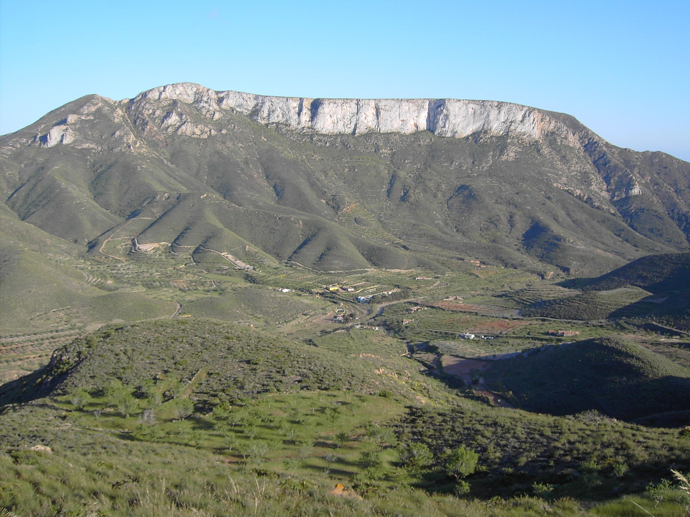
Bonita subida a un monte emblemático de la zona. Las vistas son espectaculares.

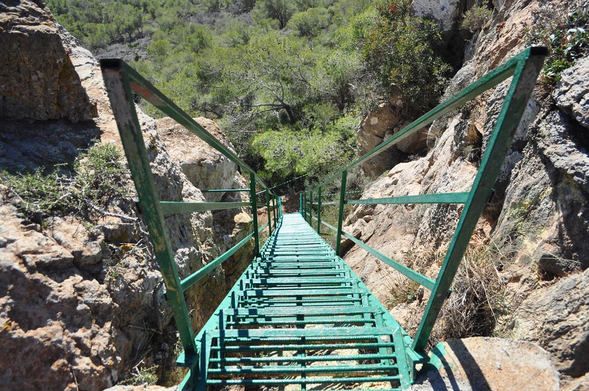
xx La ascensión no tiene dificultad técnica alguna, hay una escalera metálica que nosotros usamos en bajada, impresiona un poco pero es sencillo.

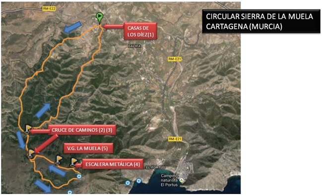
  1.  Nombre de la ruta : Circular Sierra de la Muela, Cartagena.
  2. Plano de ruta y datos :

Sin título

  • Distancia: 10, 8 km.
  • Ruta circular: Sí.
  • Cotas. Mínima 169 m. Máxima 599 m.
  • Tiempo empleado: 2 h. 40′.

3. Perfil :

perfil sierra de la muela

4. Descripción de la ruta :

Desde Cartagena, salimos dirección “Canteras” por la RM-E22. Al salir de canteras, nos encontramos con un desvío que nos llevará hasta la playa de El Portús y Galifa. Seguimos en dirección Galifa hasta llegar a Los Díez.

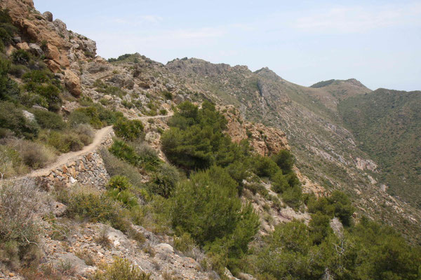
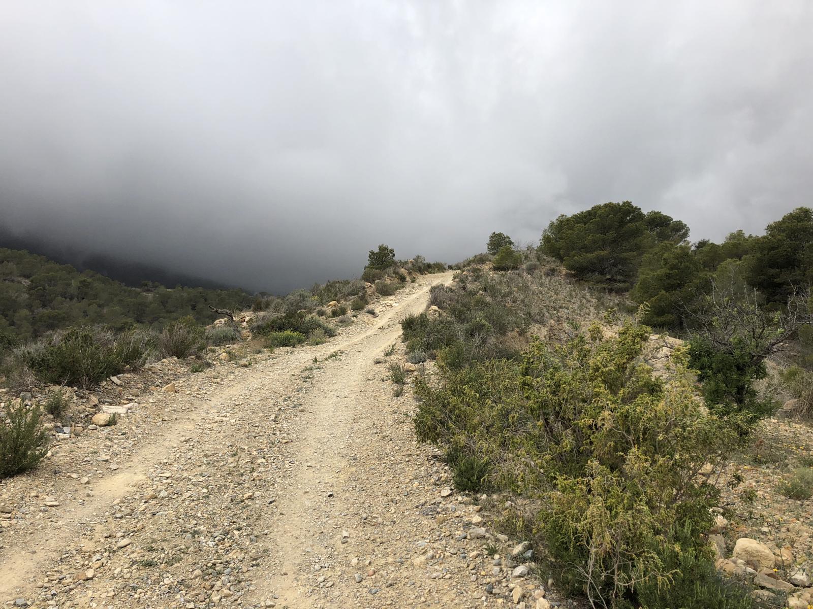
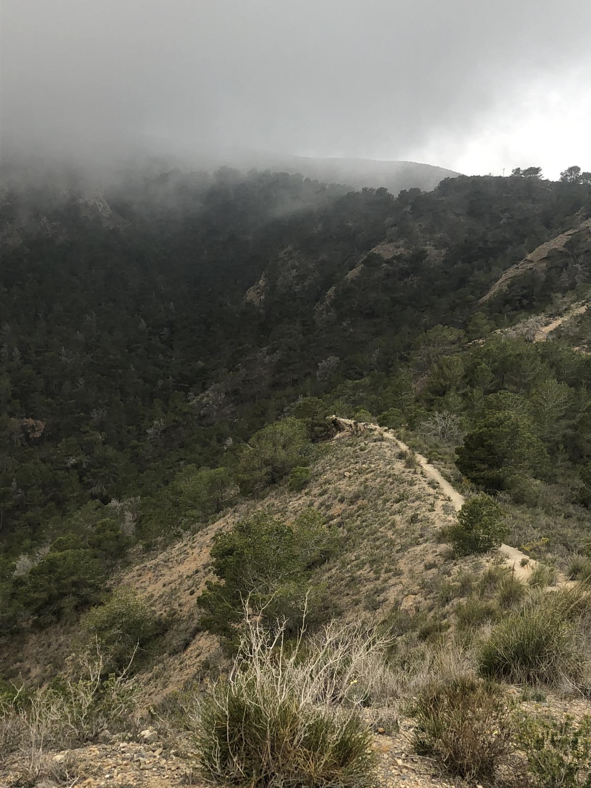
Desde Casas de Los Diez, solo hay que seguir la primera cuesta que vemos, junto a la denominada “Casa de la Pradera”, la cual nos llevará por una pista primero y un estrecho sendero después, hacia las inmediaciones de la cima. El camino es un poco rompe-piernas dado que va siguiendo la cresta de las lomas, con lo que subimos y bajamos constantemente.
subida sierra de la muela

En la ruta están marcados dos cruces de caminos, entre los cuales el trayecto es de ida y vuelta. El primer cruce nos servirá para variar el camino de vuelta al punto de inicio y el segundo nos marcará el sentido circular a la cima de la sierra. Entre los kilómetros 4 y 5 tenemos la sensación de que bajamos más de lo debido pero desde el kilómetro 5, la subida se vuelve más exigente, como debe ser si queremos llegar a lo más alto.
lo mas alto

En el kilómetro 6 nos encontramos una grata sorpresa: una escalera metálica para subir a la cresta.
escalera

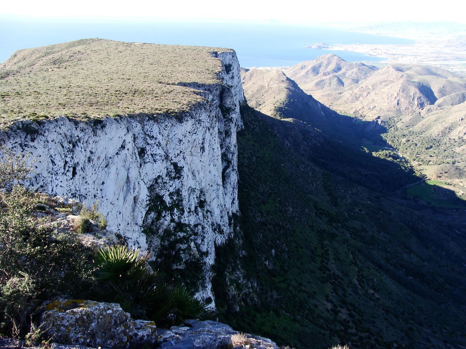
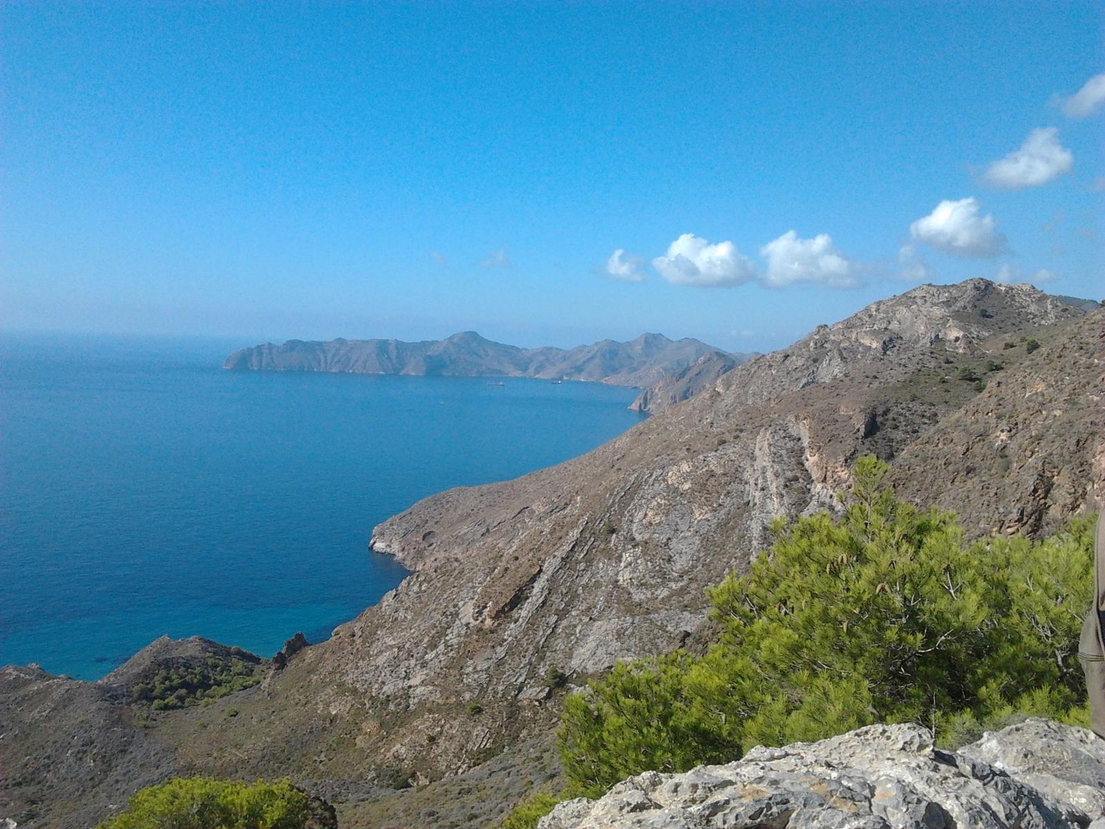
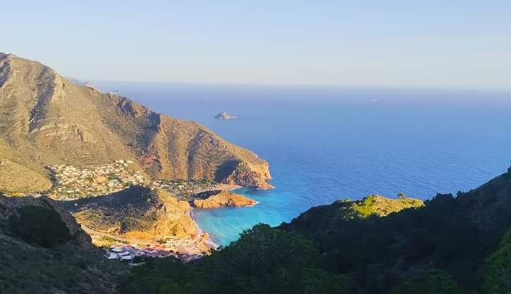
Las vistas al Mediterráneo, desde el vértice, son sencillamente espectaculares; en esta foto nuestro camping y la isla de las Palomas al fondo.
el portus desde la muela

El imponente monte Roldan y demás alturas de Cartagena son visibles desde la Muela. El Vértice Geodésico se encuentra junto a unas antenas. Desde ahí, completamos el sentido circular hacia el segundo cruce de caminos y para terminar, en el primer cruce de caminos cogemos la segunda variante (nace a nuestra derecha según el sentido de la marcha), la cual nos llevará a los aledaños de las Casas de los Díez por el extremo opuesto al de entrada.

UN PASEO EN PIRAGUA

Si el mar está plato, es posible ver nítidos los fondos llenos de vida y con tres ecosistemas que la UE manda preservar: praderas de poseidonia, arrecifes y bancos de arena en los que las especies pelágicas desovan. Nada más salir de la ensenada, aparecen en toda su grandiosidad las paredes de este litoral de profundas aguas, que habitan rorcuales y cachalotes, delfines y peces espada, enormes peces luna y escurridizos pulpos.

nuestra costa

Con base en El Portús, enclavado en el parque natural de La Muela y Cabo Tiñoso, una de las joyas del mediterráneo, contamos con zonas de playas y acantilados libres de ningún tipo de construcción, ofreciéndonos la oportunidad de disfrutar de rutas  en un lugar de especial belleza paisajística e ineludible interés ecológico.

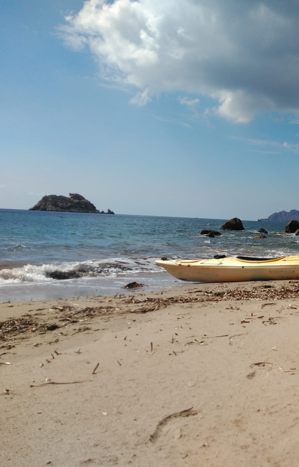
Os proponemos, una vez podamos hacer salidas por el mar, un fabuloso paseo en piragua partiendo de nuestra playa, Cala Morena, dirección Cartagena, allí encontraremos grandiosos acantilados, cuevas sorprendentes e incluso podrás navegar hasta la cala de Fatares junto a la Isla de Las Palomas.
fatares3

CUEVA DEL GIGANTE

Ubicada a escasos 30-40 minutos de la playa del El Portús (dirección Cartagena) posee varios atractivos que la convierten en un destino que no te puedes perder. En su interior descubriremos un lago de agua salobre que ofrece un baño que te resultará difícil de olvidar.

En kayak la cueva del Gigante

Si seguimos navegando por nuestra costa, llegamos a la Cala de Fatares. Esta foto está tomada desde el mirador del monte Roldán.

FATARES 2

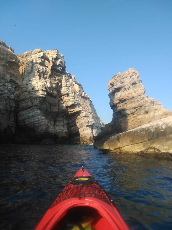
Se trata de una playa virgen y de difícil acceso, únicamente posible en barco o kayak, o a través de una larga ruta de senderismo a través del espacio natural de la Sierra de la Muela, Cabo Tiñoso y Roldán. Una vez allí puede contemplarse la isla de las Palomas, a 1 km de la costa.

isla kayak paloma

Este pequeño islote de forma cónica que apenas sobrepasa la hectárea de superficie, es posadero y criadero de aves marinas, por lo que se ha calificado como Área de Protección de la Fauna Silvestre.

En 2008 estudios arqueológicos demostraron la existencia de varios pecios o restos de naves naufragadas en los alrededores de la isla por lo que también ha sido declarada como una de las Islas e Islotes del Litoral Mediterráneo de la Región de Murcia.
acercándonos a isla paloma

La isla es perfectamente visible en la ruta Tentegorra – Monte Roldán, una vez que llegas al mirador de Roldán y te encaminas hacia la playa de Fatares.
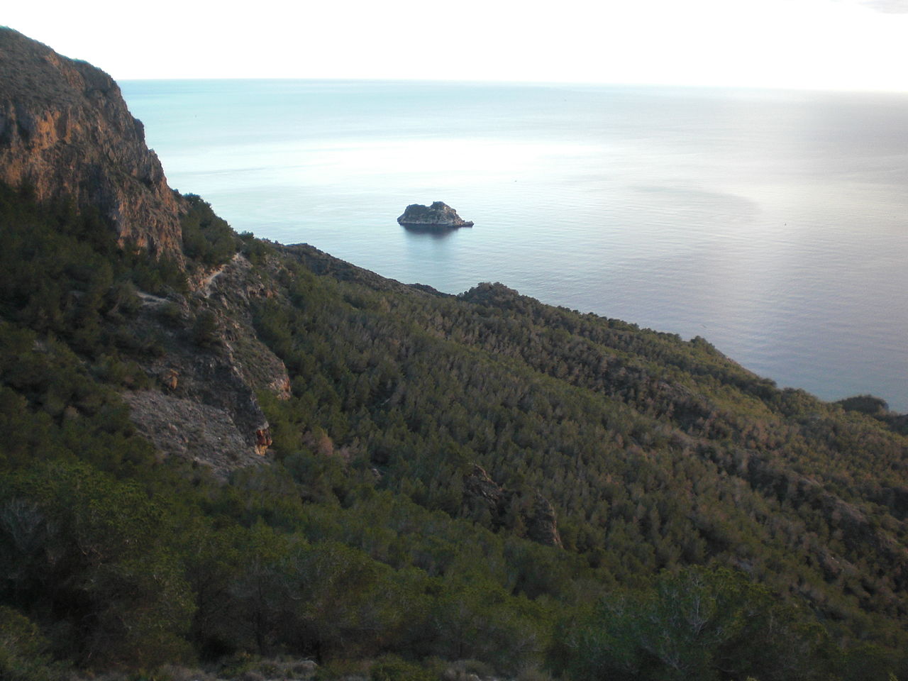
isla de las palomas

Como consejo,  es importante que lleves agua y otros elementos en tu equipo de piragüismo: escarpines o botines, ropa de neopreno, casco y bolsa impermeable para proteger ciertos objetos del agua, como el móvil, cámara de fotos o documento, y cuando andes por la montaña, consulta antes el tiempo, ves acompañado si puedes, vestimenta adecuada, agua y el móvil y sobre todo no te preocupes por el ritmo, ni por la distancia, tan solo disfruta del ambiente que te rodea, dejándolo de la misma forma que te lo encontraste.

Para terminar este artículo, quiero hacerlo con una foto tomada desde un sendero de Gran Recorrido o sendero GR, denominación que recibe aquel sendero de una red europea de caminos, presente principalmente en Francia, España, Bélgica y Países Bajos, desde el cual podemos devisar nuestro pequeño gran paraíso.
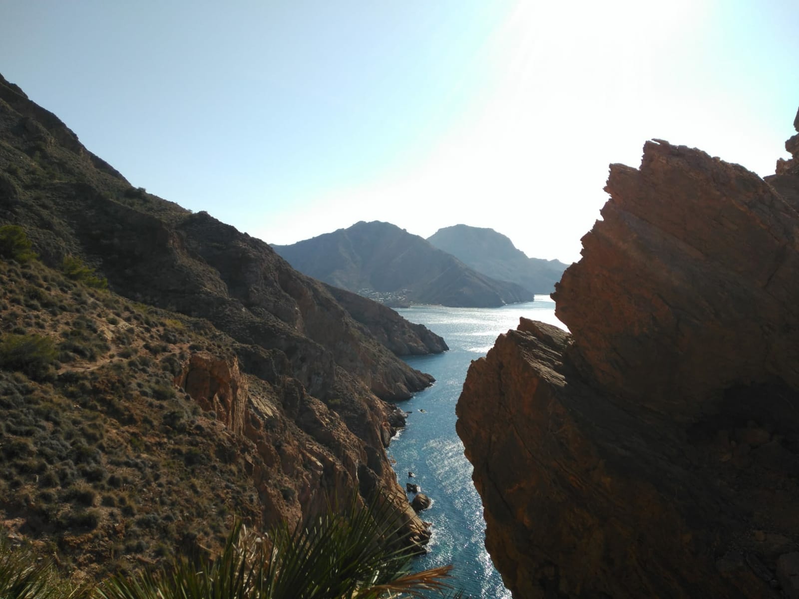
GR92


ENJOY THE ENVIRONMENT AROUND HERE

In this second chapter dedicated to our local environment we propose a series of routes for lovers of the mountains and the sea, a very healthy way to get out of the routine by going back to nature and respecting the environment in all its forms.

We propose a visit to Mount Roldán and a route to the Sierra de la Muela to introduce you to the land and countryside and an attractive canoe ride around our coastline visiting La Cueva del Gigante, Fatares beach and the Isla de las Palomas.

MONTE ROLDÁN TRAIL

The ascent to Mount Roldán, in the Sierra de La Muela, Cabo Tiñoso and Roldán Natural Area, offers us, at 490 meters above sea level, impressive views of the Cartagena coastline. During the tour you can enjoy a natural environment of high ecological value and visit the Roldán gun battery on the mountain’s summit which has been declared a Site of Cultural Interest.

Type: Circular
Distance: 5.7 km
Estimated time: 2 h and 30 min.
Difficulty: medium
Difference in altitude: 450 m
Start and end: parking next to the installation of the Taibilla canals, Tentegorra.

To know a bit more…

«When Roldán has its fur hat on it will rain in Cartagena, God willing or not» (Popular saying)

Monte Roldán, due to its proximity to the city of Cartagena and its attractive landscape, is highly popular for hiking, cycling, mountain races and all kinds of recreational activities. It is also the scene of important sporting events such as the “Ruta de las Fortalezas” race.

This intense use of space has an impact on the environment such as:

Soil erosion.
Vegetation loss due to the proliferation of shortcuts.
Careless and thoughtless litter  dropping.

Disturbing the wild animals.

To continue enjoying the privileges that Mount Roldán offers us, it is essential to follow a series of recommendations and good practices that will contribute to the conservation of the natural values it houses.

WE WILL SHOW YOU!

Good practice manual

When using a trail you should not leave it, nor take shortcuts. This way you respect the plants and animals that live in the vicinity of your walk, and avoid soil erosion.
If you are a cyclist, for your safety and that of others, respect the speed of 20 km / h and slow down when you meet other users, as well as on the bends or points with poor visibility.
The organization of sports activities in the Natural Space requires  prior authorization from the Ministry of the Environment.
Pets can scare and disturb wild animals or other visitors. Keep them on a lead and under proper control.
LEAVE NO TRACE  of your visit,  take ALL  litter home with you.
With a photo you can take all nature home, without damaging the flora, fauna and geology of the place.

ROUTE SIERRA DE LA MUELA

It is time to return to the mountain, to enjoy that peace and tranquillity that the mountains, their trails and their views give.

This is a beautiful climb to an emblematic mountain in the area. The views are spectacular.

The ascent does not have any technical difficulty, there is a metal staircase that we use to ascend and descend, it is a bit impressive but it is simple as long as you do not suffer from vertigo.

Name of the route: Circular Sierra de la Muela, Cartagena.
Route plan and data:

Distance: 10, 8 km.
Circular route: Yes.
Dimensions. Minimum 169 m. Maximum 599 m.
Time spent: 2 h. 40 ′.

4. Description of the route:

From Cartagena, we turn left towards “Canteras” on the RM-E22. When leaving Canteras, we find a detour, a left fork,  that will take us to the beach of El Portús and Galifa. At Venta La Muela we continue straight on towards Galifa until we reach Los Díez.

From Casas de Los Diez, just follow the first slope that we see, next to the so-called “Casa de la Pradera”, which will take us along a track first and a narrow path later, in the direction of the summit. The path is a bit uneven since it follows the ridge of the hills, so we go up and down constantly.

Two road crossings are marked on the route, between which a shorter  round trip is available. At the first crossing we can take the shorter route back to the starting point and the second will take us on the longer route to the top of the mountain. Between kilometers 4 and 5 we feel that we descend more than we should but from kilometer 5 the climb becomes more demanding as it must if we want to reach the top.

At kilometer 6 we find a pleasant surprise: a metal staircase to climb the ridge.

The views of the Mediterranean from the top are simply spectacular. In this photo is our campsite with the island of Las Palomas in the background.

The imposing Mount Roldan and other heights of Cartagena are visible from La Muela. The Geodesic Vertex is next to some antennas. From there, we complete the circular direction towards the second crossroads and to finish, at the first crossroads we take the second variant (it is on our right according to the direction of the march), which will take us to the outskirts of Las Casas de los Díez at the opposite end of the entrance.

A TRIP IN  A KAYAK

If the sea is flat, it is possible to clearly see the depths full of life and the three ecosystems which have EU conservation orders, meadows of poseidonia, reefs and sandbanks in which the oceanic species spawn. As soon as you leave the cove, the walls of this deep-water coastline appear and the  depths of the abyss are inhabited by whales and sperm whales, dolphins and swordfish, huge sunfish and elusive octopuses.

Based in El Portús, nestled in the natural park of La Muela and Cabo Tiñoso, one of the jewels of the Mediterranean, we have areas of beaches and cliffs free of any form of human development, offering us the opportunity to enjoy routes in a place of special landscape beauty and incomparable ecological interest.

We suggest, once we can go out on the sea, a fabulous canoe ride starting from our beach, Cala Morena, towards Cartagena, there we will find great cliffs, surprising caves and you can even navigate to Fatares cove next to the Isla de Las Pigeons.

CAVE OF THE GIANT

Located just 30-40 minutes from El Portús beach (towards Cartagena), it has several attractions that make it a destination that you should not miss. Inside we will discover a brackish water lake that offers a memorable bathe.

If we continue sailing along our coast, we arrive at Cala de Fatares. This photo is taken from the viewpoint of Mount Roldán.

It is a virgin beach with difficult to access, only possible by boat or kayak, or through a long hiking route through the natural area of Sierra de la Muela, Cabo Tiñoso and Roldán. Once there you can see the island of Las Palomas, 1 km from the coast.

This small cone-shaped islet that barely exceeds one hectare in area, is a sanctuary and breeding ground for seabirds, which is why it has been classified as a Wildlife Protection Area.

In 2008 archaeological studies revealed the existence of several  shipwrecks in the surrounding area of the island, which is why it has also been declared a Protected Area,  the Islands and Islets of the Mediterranean Coast of the Murcia Region.

The island is perfectly visible on the Tentegorra – Monte Roldán route, once you get to the Roldán viewpoint and head towards Fatares beach.

As a tip, it is important that you carry water and other items in your canoeing equipment: booties or ankle boots, wetsuits, a helmet and a waterproof bag to protect certain objects from the water, such as a mobile phone, photo camera or documents, and when you walk around the mountain, check the weather beforehand, never go alone, wear adequate clothing, take water and a mobile and above all do not worry about the pace, nor the distance, just enjoy the environment around you, leaving it in the same way as you found it.

To end this article, I want to use a photo taken from the long distance trail or GR trail which is part of a European network of roads  present in France, Spain, Belgium and the Netherlands, from which we can appreciate our great little paradise.


Publicado en QUÉ HACER / WHAT TO DO, RECOMENDACIONES/RECOMMANDATIONS | 2 comentarios

Nuestro entorno más cercano

Sierra de la Muela, Cabo Tiñoso y Roldán

En este primer capítulo abordaremos con entusiasmo la grandeza de nuestro Espacio Natural más cercano.

La playa y el poblado de El Portús se encuentran situados dentro del Parque Natural de la Sierra de la Muela, Cabo Tiñoso y Roldán, un espacio protegido de gran valor ecológico.

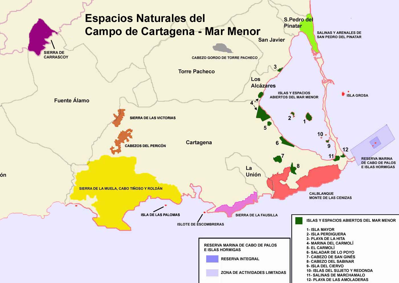
Al oeste de Cartagena y a lo largo del sur de la Región de Murcia se extiende este espacio natural protegido de 11.361 hectáreas, que es uno de los más extensos y variados de la región. Su gran superficie favorece la variedad de paisajes y su riqueza tanto geológica como biológica.

Espacios_naturales_Mar_Menor02

La máxima altura de la sierra es el pico de Peñas Blancas, en una zona de fuertes pendientes, mientras que en su área costera encontramos bahías, acantilados y playas, donde el agua  llega a los 200 metros de profundidad.

Digital StillCamera

otra peñas blancas

Casi toda la Sierra pertenece al municipio de Cartagena.  Desde el Monte Roldán,  se disfruta de unas magníficas vistas de todo el litoral cartagenero a 490 metros sobre el nivel del mar, hasta el término de Isla Plana, pasando por la Sierra de la Muela, Cabo Tiñoso, el Portús y la Azohía, entre otros. La sierra también se adentra, aunque levemente, en los municipios de Mazarrón y Fuente Álamo.

Sierradelamuela

roldan si

Cartagena desde monte Roldan

La sierra, protegida por la legislación de la comunidad autónoma, está declarada Lugar de Importancia Comunitaria (LIC) y Zona de Especial Protección para las Aves (ZEPA) debido a la existencia de colonias de halcones peregrinos, búhos y águilas reales, currucas, alcaravanes, piquituertos y un largo etcétera que conforma una gran familia ornitológica de inestimable valor. También se pueden encontrar mamíferos como zorros, gatos monteses, ginetas y jabalíes.

Gineta

zorro comun

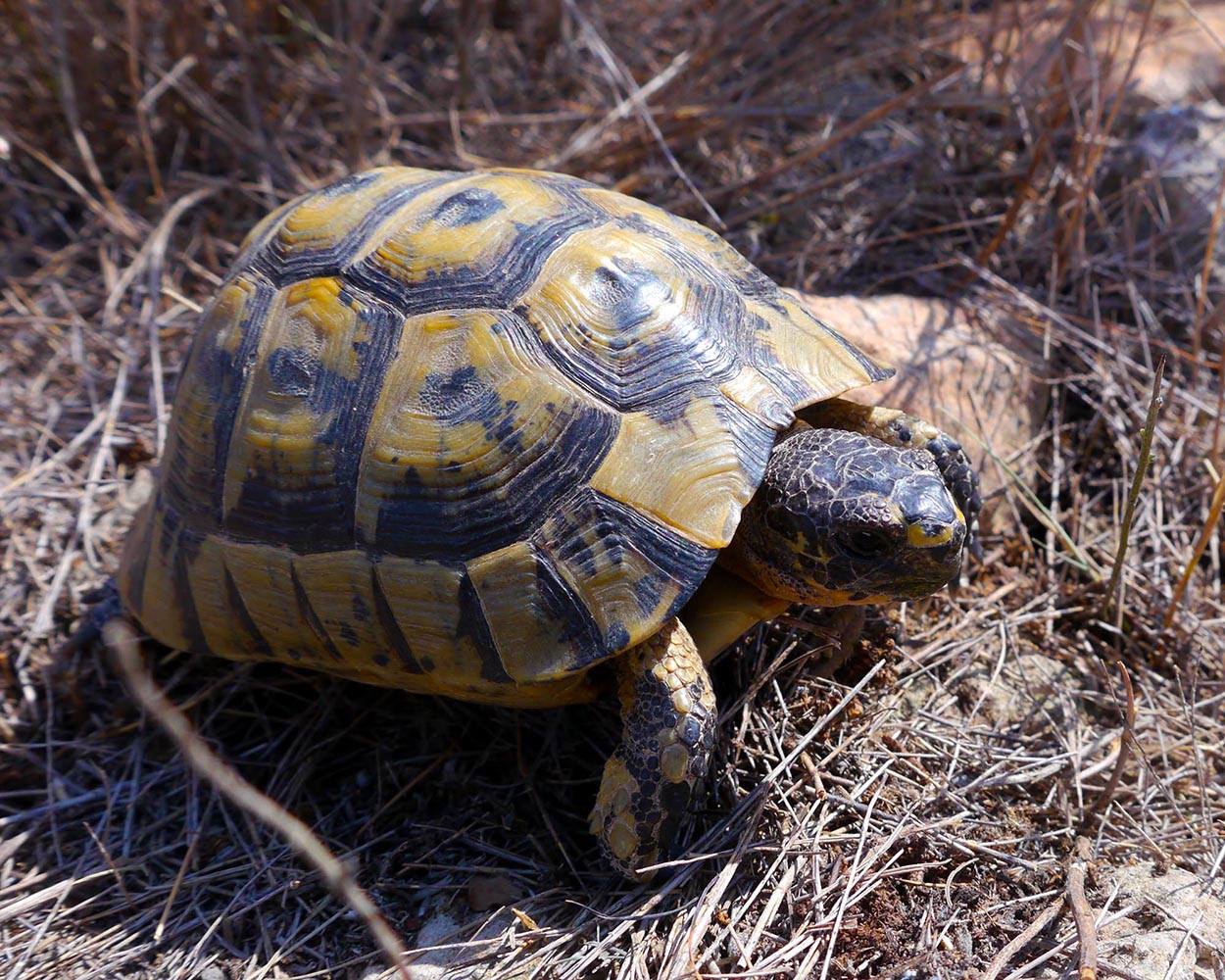
En este espacio existen especies protegidas como la tortuga mora o algunos tipos de murciélagos, entre los que destaca el murciélago grande de herradura. Es frecuente encontrar también el camaleón común.

tortuga mora 2

Entre las aves, se encuentran el halcón peregrino,búho real, águila real , y el águila perdicera, existen gran número de aves en la zona entre las que destacan diversas especies de currucas, Alcaravanes , diversos Fringilidos, Alzacolas, Piquituertos, Camachuelo trompetero, etc.

halcon peregrino

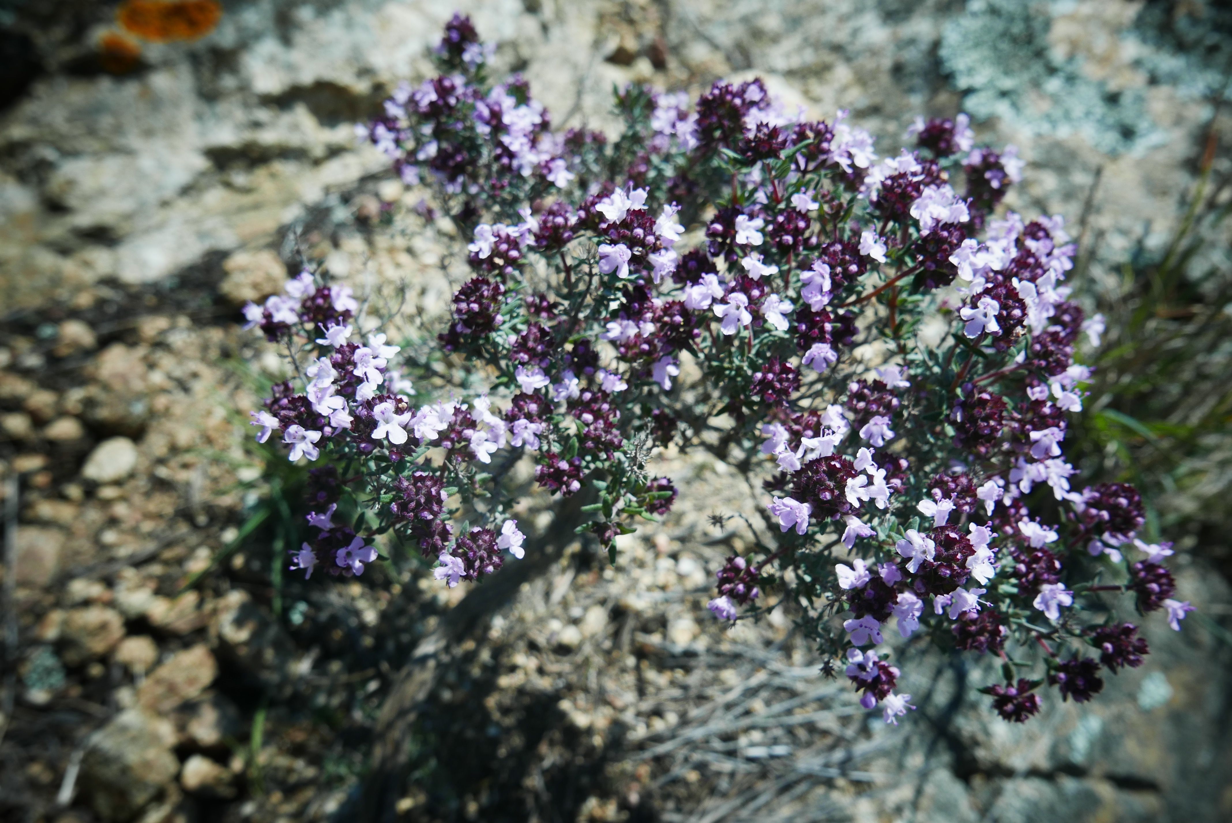
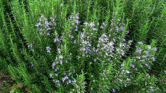
En cuanto a su flora, este parque regional destaca por una gran variedad de ambientes, desde el típico bosque mediterráneo compuesto por pinos carrascos, romeros, tomillares o garrigas hasta colonias propias de ambientes áridos inframediterráneos formadas por palmito, enebro, romero o esparto.

tomillo comun

Romero-arbusto_opt

diente de leon

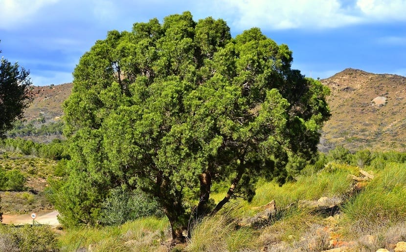
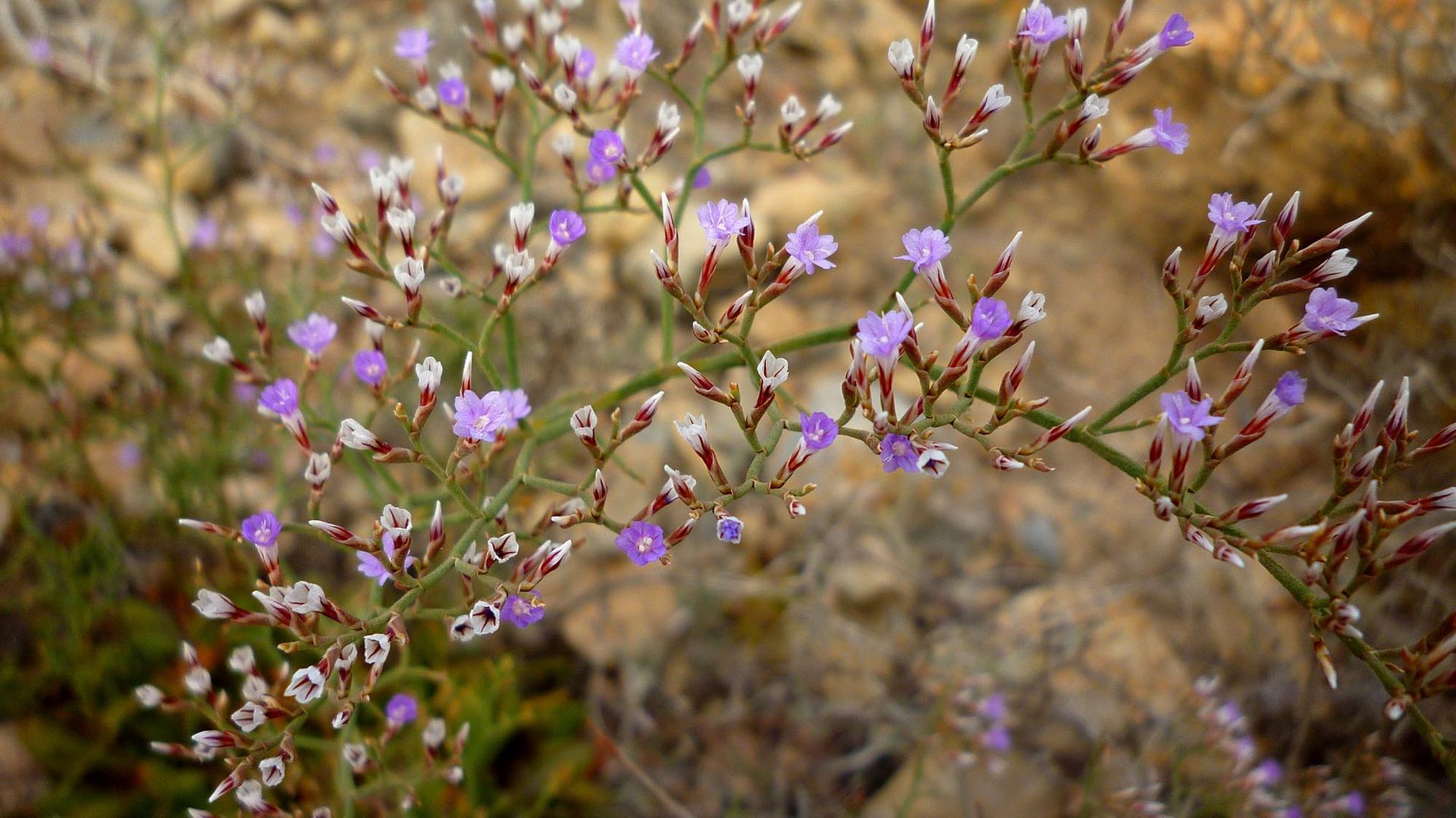
Sin embargo, es la exclusividad de algunas especies endémicas lo que hace destacar al parque, con especies únicas como el ciprés de Cartagena, la manzanilla de Escombreras, la siempreviva cartagenera, el ajo negro o la varica de San José.

Tetraclinis-articulata-Cipres-de-Cartagena

siempreviva cartagenera

algarrobo

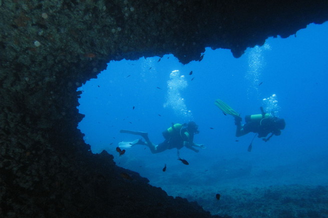
Especial mención merecen los fondos marinos de Cabo Tiñoso, referencia nacional para submarinistas por su extensión, riqueza y diversidad.

INMERSION EN CUEVA DEL LAGO O DEL ARCO EN CABO TIÑOSO

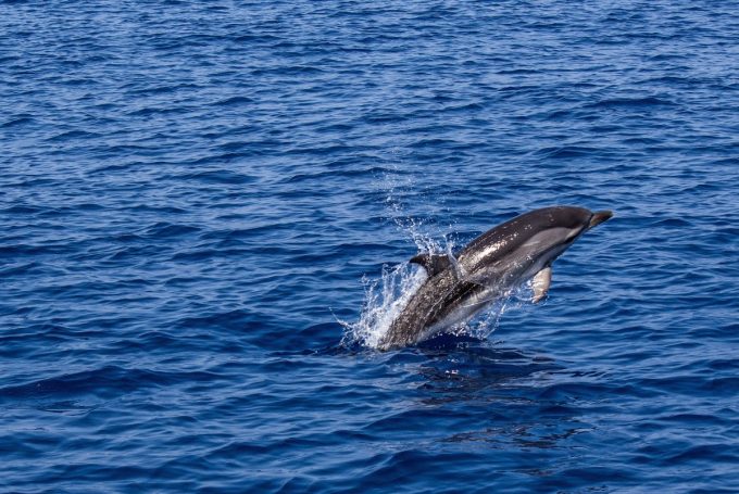
Por último, acabamos este capítulo de nuestro entorno más cercano, con la presencia de delfines en nuestras aguas; quizás no lo sepas, pero nuestro litoral es uno de los pocos lugares de Europa en los que es posible avistar cetáceos. El clima benigno y la profundidad de las aguas -de entre 2.000 y 2.500 metros-  hacen que los delfines comunes, delfines listados, mulares, los calderones o rorcuales comunes habiten en nuestras aguas. 

delfin cabo tiñoso

En los siguientes capítulos, exploraremos nuestra sierra más a fondo, con fantásticas rutas para los amantes del senderismo.

Recuerda que estás en un Espacio Natural, este entorno necesita de tu cuidado para que todos podamos disfrutarlo.

Our Natural Surroundings

In this first chapter, we will carefully address the value of our closest Natural Area.

The beach and the village of El Portús are located within the Natural Park of Sierra de la Muela, Cabo Tiñoso and Roldán, a protected area of great ecological value.

To the west of Cartagena and along the south of the Region of Murcia where this protected natural area of 11,361 hectares extends is one of the most extensive and varied in the region. Its large area favors a wide variety of landscapes and its richness includes both geological and biological elements.
The maximum height of the mountain range is the Peñas Blancas peak in an area of steep slopes, while in its coastal area there are bays, cliffs and beaches and parts of the sea where it reaches a depth of 200 meters.

Almost all the Sierra belongs to the municipality of Cartagena. From the summit of Monte Roldán, at 490 meters above sea level, you can enjoy magnificent views of the entire Cartagena coastline to the municipality of Isla Plana, crossing the Sierra de la Muela, Cabo Tiñoso, Portús and Azohía, among others. The mountains also enter, albeit slightly, the municipalities of Mazarrón and Fuente Álamo.

The mountain range, protected by the legislation of the autonomous community, has been declared a Site of Community Importance (SCI) and a Special Protection Area for Birds (ZEPA). Due to the existence of this protection there are a large number of birds in the area, among which there are peregrine falcon, eagle owl, golden eagle, and Bonelli’s eagle, several species of warblers, stone curlew, red legged partridge, various finches, Scop’s owl, bush robin, crossbills, bullfinch  among others. This forms a great ornithological family of inestimable value. Mammals such as foxes, wildcats, genets, and wild boars can also be found.

In this space there are protected species such as the spur-thighed tortoise or some types of bats, among which the large horseshoe bat stands out. It is frequent to also find the common chameleon.

As for its flora, this Regional Park stands out for a great variety of environments, from the typical Mediterranean forest composed of Aleppo pines, rosemary, thyme or garrigue to colonies typical of arid infra-Mediterranean environments formed by palm heart, juniper, rosemary or esparto grass.

However, what makes the Park stand out is the exclusivity of some endemic species, with unique species such as the Cartagena cypress, the Escombreras chamomile, the evergreen from Cartagena, the Cartagena Cistus and black garlic or the varicose vein of San José.

The seabed of Cabo Tiñoso deserves special mention, a national reference for divers for its extension, richness and diversity.

Finally, we finish this first chapter of our closest environment, with the presence of dolphins in our waters; our coastline is one of the few places in Europe where it is possible to see cetaceans. The good climate and the depth of the waters – between 2,000 and 2,500 meters make common dolphins, striped dolphins, bottlenose dolphins, pilot whales or fin whales live in our waters.

In the following chapters, we will explore our mountains more fully, with fantastic routes for hiking enthusiasts.

Remember that you are in a Natural Space, this environment needs your care so that we can all enjoy it.

Publicado en CURIOSIDADES / CURIOSITIES | 4 comentarios

María Jesús, naturista del Portús. Viñeta 79

mariajesus79-gd

– Oh Aurelio, only the older people have stayed in the campsite! This crisis, Gods!
– It is hard, but they are coping very well. They do a lot of activities! And a lot of exercise!
– You see them getting stronger.
– And some! Who do you think unload the supply trucks?

Publicado en MARÍA JESÚS | 2 comentarios