
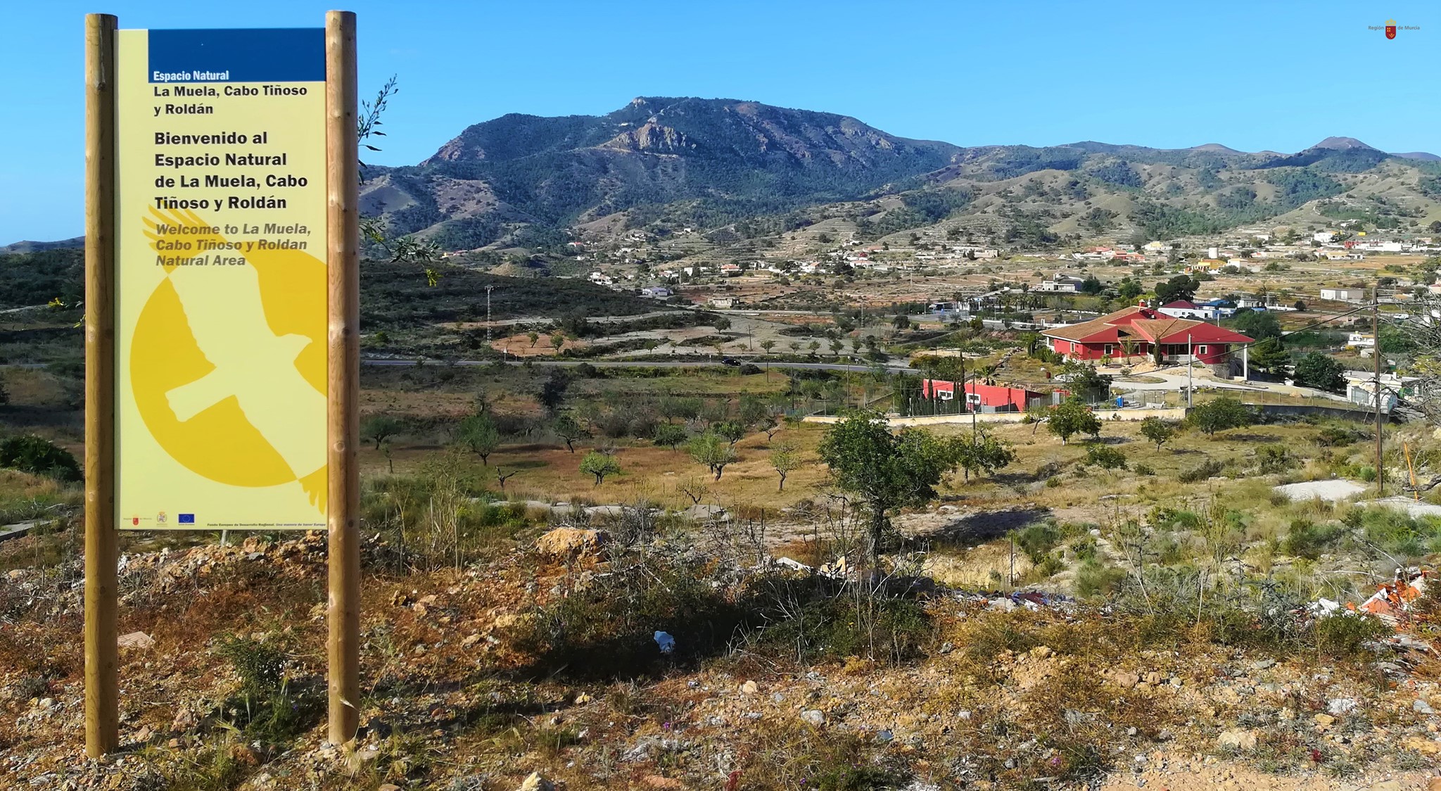
A unos 9 km al oeste de la ciudad de Cartagena, a cuyo término municipal pertenece, se encuentra la población de Galifa en la carretera que conduce a El Portús dentro de la diputación de Perín
El pueblo se encuentra dentro del Parque Natural de la Sierra de la Muela, Cabo Tiñoso y Roldán, un espacio protegido de gran valor ecológico.
Según el censo municipal de 2008 la población de Galifa ascendía a 247 habitantes, de los cuales 25 eran extranjeros.
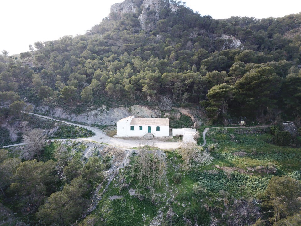
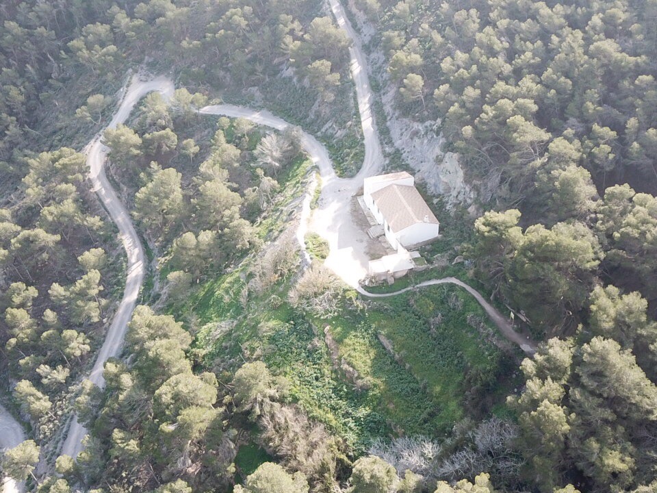
Las fiestas populares de Galifa se celebran del 29 de junio al 16 de julio, fecha esta última en la que se celebra la festividad de la Virgen del Carmen en la cual se celebra una romería en la que trasladan la imagen de la Virgen a su ermita, construida en 1879 y en la que celebra misa todos los domingos. Es una sencilla edificación de planta baja rectangular con una nave principal, tejado a doble vertiente, fachada sencilla con acceso de arco de medio punto y con dos hornacinas donde están las imágenes de San Rafael y San Enrique.
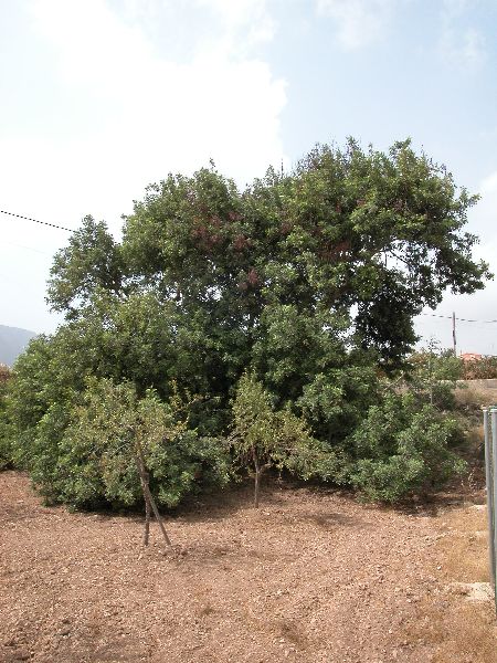
En este lindo pueblo de nuestro campo, situado a mitad de camino de la carretera que lleva hasta nuestra playa de El Portús, podemos encontrar un árbol muy especial: el Garrofero. Es un algarrobo conocido como el Algarrobo de Galifa, que, no es el de mayor tronco de la Región pero sí uno de los más notables. Está muy bien conservado y es el de mayor envergadura. Tiene más de 500 años y cuenta con siete largas ramas, que se apoyan directamente en el suelo. Es uno de los algarrobos más antiguos y de mayores dimensiones de la Región de Murcia. Alcanza los 11 metros de altura y los 5,75 metros de cuerda. Muy cerca de este ejemplar único se encuentra otro algarrobo de 4,40 metros de perímetro y cerca de Galifa hay más algarrobos centenarios.
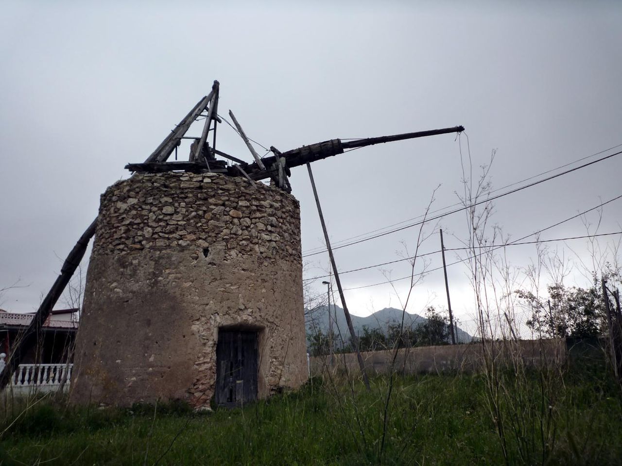
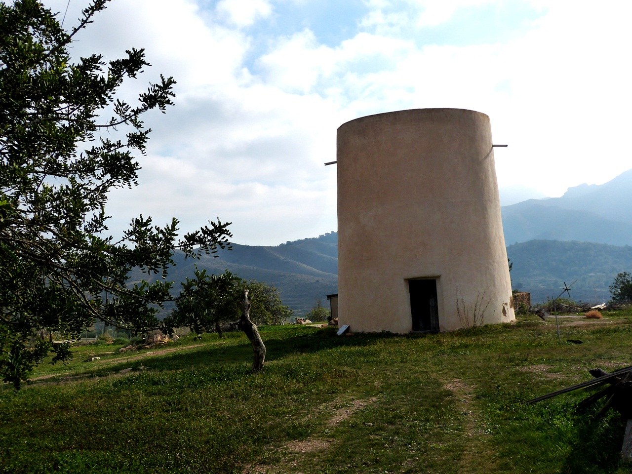
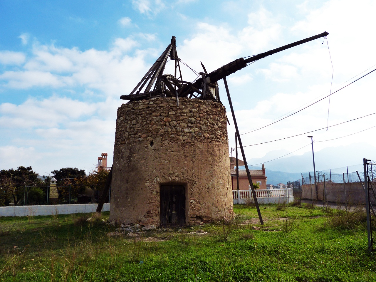
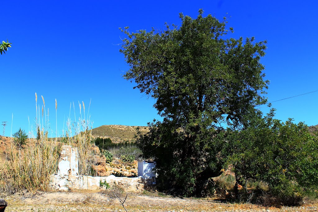
En esta misma carretera de la Playa del Portús, en el caserío de Galifa, hay un magnífico molino de viento, hoy en ruinas, pero que aún conserva una bella estampa digan de ser fotografiada mientras se disfruta pensando en lo que en su día fue.
SENDERO DE GALIFA, RUTA DEL AGUA
Dar a conocer estas zonas de gran belleza y valor ambiental contribuye a conservar, mantener y poner en valor los recursos naturales y paisajísticos del territorio.
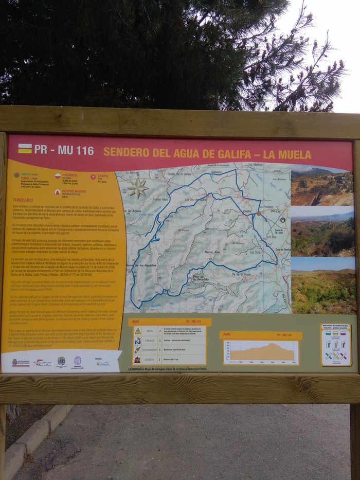
En el recorrido Sendero del Agua de Galifa podemos disfrutar del maravilloso entorno por el que transcurre y el rico patrimonio que atesora: molinos de viento, árboles monumentales, canalizaciones y galerías, así como construcciones tradicionales del Campo de Cartagena. Es también una oportunidad para descubrir los valores de la Sierra de la Muela como Espacio Natural.
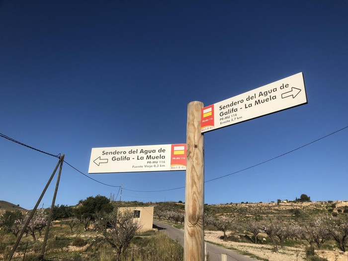
El ¨Sendero del Agua de Galifa ¨permite conocer las infraestructuras que diferentes compañias de agua construyeron durante el siglo XIX y hasta mitad del siglo XX para abastecer a la ciudad de Cartagena.
Al inicio del sendero se encuentra la ermita de Galifa, y los molinos de viento del tío Lázaro y del tío Ginés.
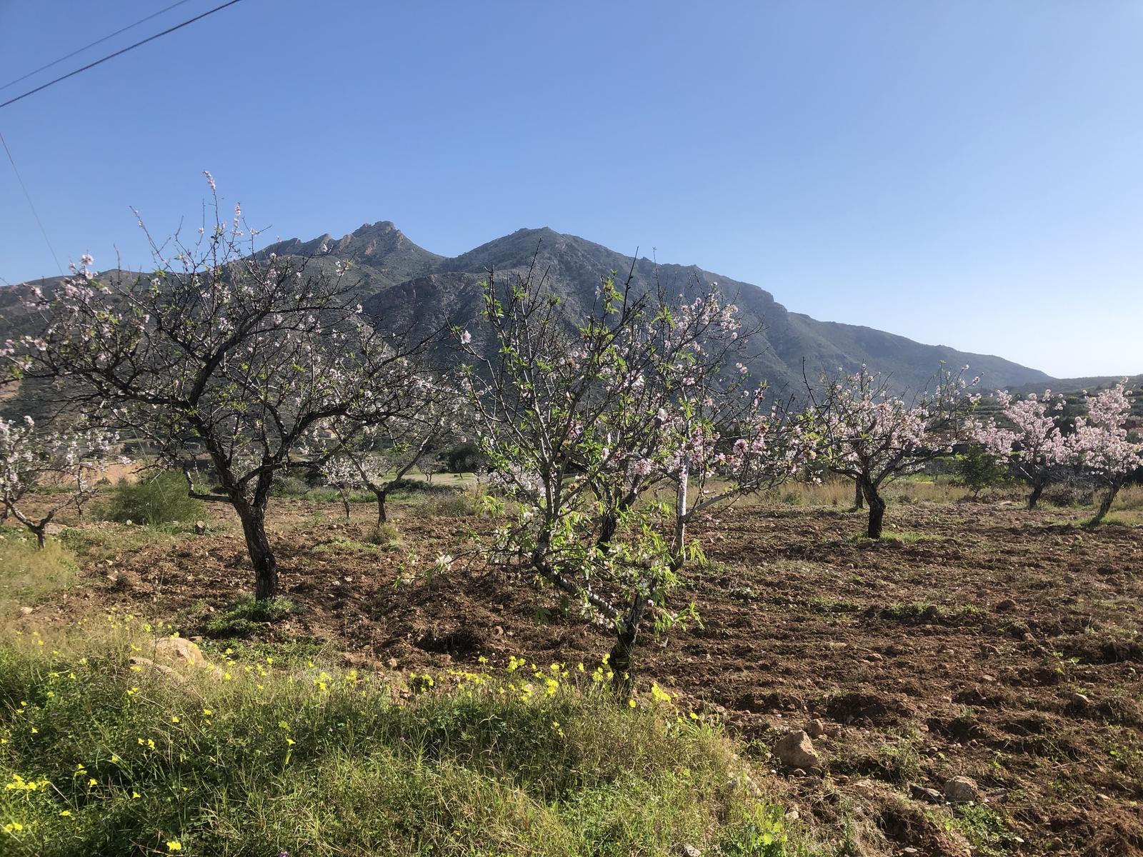
El sendero PR-116 se adentra en el paisaje agrario de Galifa, mostrando cultivos tradicionales de algarrobo y almendro en secano.
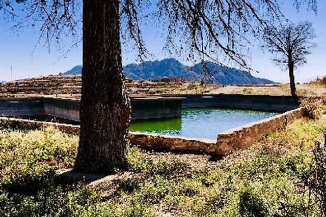
A 3 km del inicio del sendero, se encuentra el depósito del Bancal Blanco, con una capacidad de 6000 m³ que pertenece al sistema de recogidas de agua de Fuente Vieja ¨gestionado por la Compañia Inglesa de aguas».
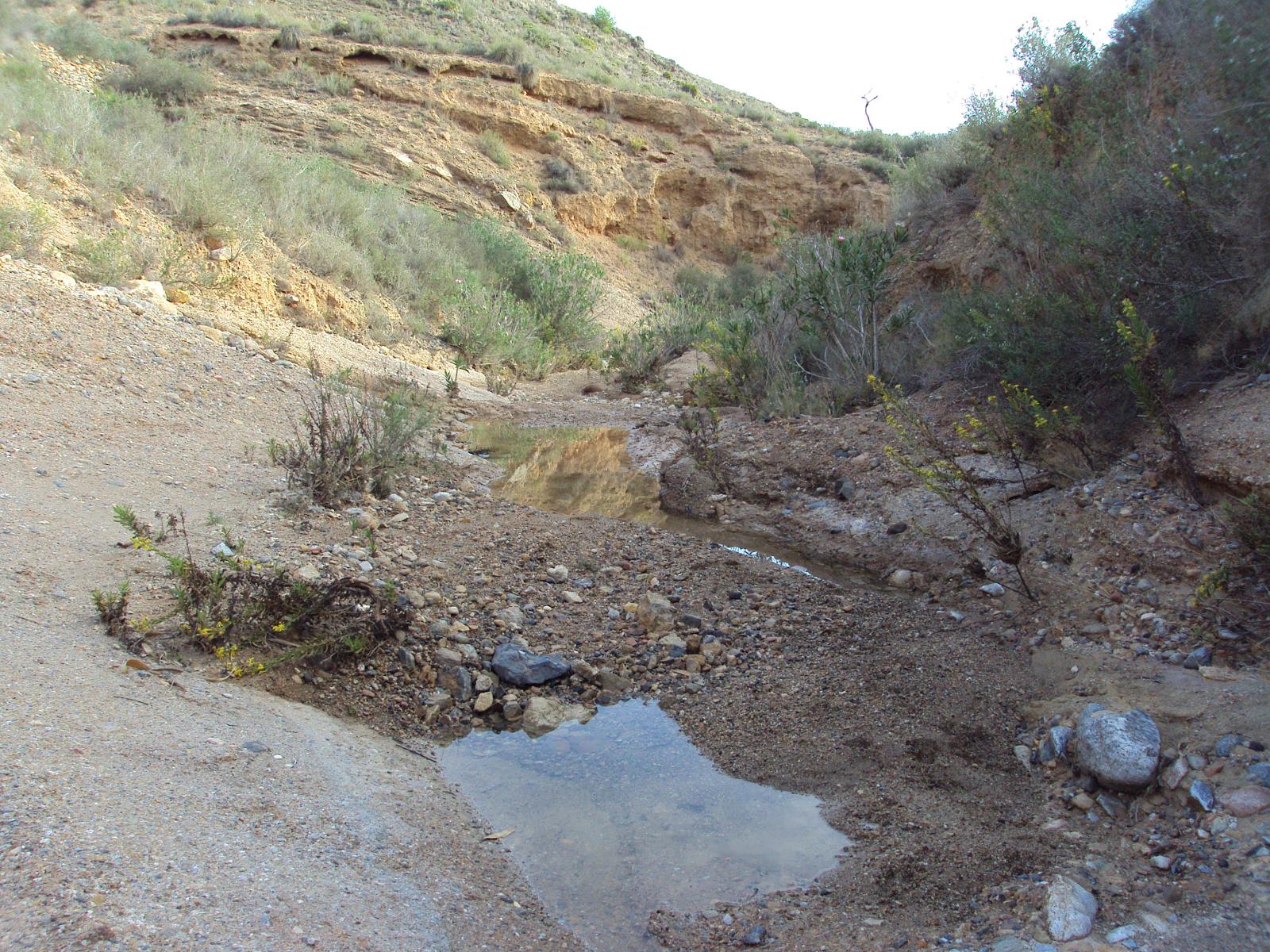
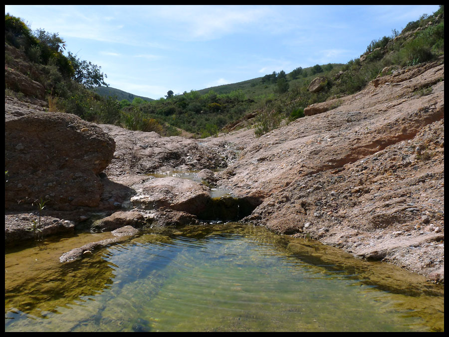
El manatial de Fuente Vieja es un pequeño salto de agua originado por la rambla del Cabezo Negro, cuyas fuentes canalizadas fueron aprovechadas para el consumo de la ciudad de Cartagena antes de la llegada del canal del Taibilla.
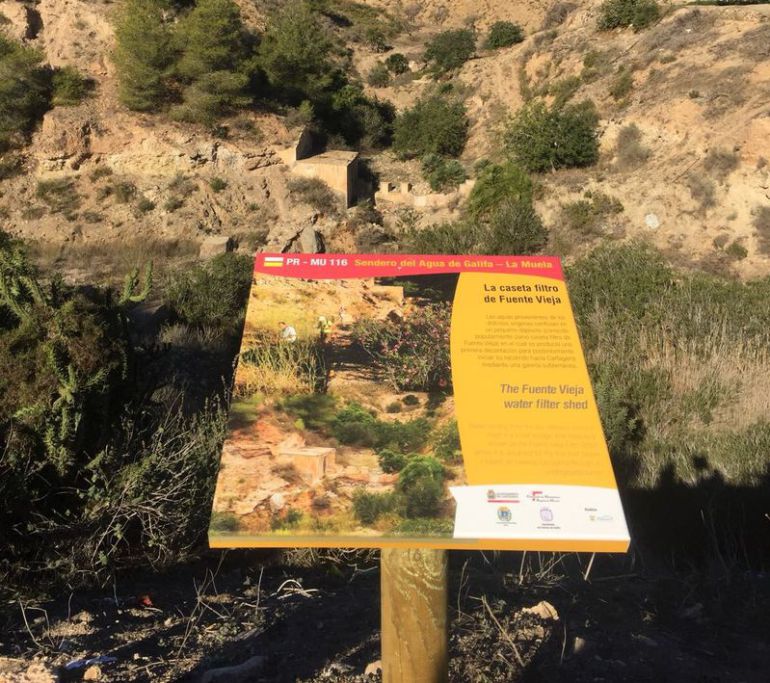
En Fuente Vieja se encuentra la caseta filtro. Es un pequeño depósito, donde confluyen las aguas para su decantación y posterior conducción al depósito del Bancal Blanco.
Aguas arriba de la caseta filtro, en la Rambla del Cabezo Negro, se pueden encontrar 3 azudes, con la función de reducir la erosión del agua.
Continuando el recorrido del sendero, se llega al Depósito de la Manda, que tenía la función de regulación del sistema de Fuente Vieja con una capacidad de 8000 m³ de agua abasteciéndose del depósito Giménez.
Más arriba, se encuentra el Depósito de Giménez, que recibía las aguas a través de un canal que conecta con un azud ubicado en la Rambla del Cabezo Negro.
La Compañía de los Cartageneros, dispuso de un sistema de pozos mediante vasos comunicantes conectados con una galería a 110 metros.
Así se transportaba el agua desde Rambla de Giménez a la Rambla del Cabezo Negro.
Enclavados entre pinares, el sistema de Fuente Vieja, dispone de 2 ¨depósitos enanos¨usados por la Compañía Inglesa para los viveros de producción de planta forestal que dieron lugar a los » Pinares del Inglés ¨.
Los caudales sobrantes del depósito enano de Rambla Giménez, se conducían a la cuenca del Cabezo Negro mediante un canal abierto y un túnel que atraviesa la divisoria entre cuencas.
El sendero transcurre por el Parque Regional Sierra de la Muela, Cabo Tiñoso y Roldán, donde viven aves como el Águila perdicera, Águila real, Halcón peregrino o el Búho Real.
Los pequeños núcleos rurales configuran el territorio de este lugar, en cuyo paisaje destacan los bancales con pedrizas que caracterizan la agricultura tradicional de Galifa.
Para aquellos que prefieran hacer turismo de naturaleza a caballo, el Club Hípico Sierra de la Muela ofrece recorridos para conocer los más singulares rincones.
Al finalizar el recorrido, se puede disfrutar de la gastronomía local en el Restaurante Casa Ramírez.
En dirección a Cartagena, junto a la carretera se encuentra el garrofero de Galifa, que es un árbol monumental e histórico.
En las proximidades de este árbol se encuentra la Venta de la Muela y una noria de sangre.
Galifa mantiene la música tradicional, celebrando en Navidad el encuentro de cuadrillas de cante de Pascua.
También en esta época, es de interés visitar el Belén artesanal de los Díaz.
Un recorrido por la cultura del agua, la flora, la fauna, los paisajes litorales, la gastronomía y las tradiciones, esperan al visitante
GALIFA
About 9 km west of the city of Cartagena, to whose municipal term it belongs, is the town of Galifa on the road that leads to El Portús within the Perín deputation.
The town is located within the Sierra de la Muela, Cabo Tiñoso and Roldán Natural Park, a protected area of great ecological value.
According to the 2008 municipal census, the population of Galifa was 247 inhabitants, of which 25 were foreigners.
Galifa’s popular festivities are held from June 29 to July 16, the latter date when the Virgen del Carmen festival is celebrated, in which a pilgrimage is held in which the image of the Virgin is transferred to her hermitage , built in 1879 and in which he celebrates mass every Sunday. It is a simple rectangular ground floor building with a main nave, a double-sided roof, a simple façade with access to a semicircular arch and two niches with the images of San Rafael and San Enrique.
In this beautiful town in our countryside, located halfway along the road that leads to our El Portús beach, we can find a very special tree: the Garrofero. It is a carob tree known as the Galifa Algarrobo, which is not the largest trunk in the Region but is one of the most notable. It is very well preserved and is the largest. It is more than 500 years old and has seven long branches, which rest directly on the ground. It is one of the oldest and largest carob trees in the Region of Murcia. It reaches 11 meters in height and 5.75 meters of rope. Very close to this unique specimen is another carob tree with a 4.40 meter perimeter and near Galifa there are more centenary carob trees.
On this same road to Playa del Portús, in the Galifa farmhouse, there is a magnificent windmill, now in ruins, but which still retains a beautiful image, worthy of being photographed while enjoying yourself thinking about what it once was.
GALIFA TRAIL, WATER ROUTE
Publicizing these areas of great beauty and environmental value helps to conserve, maintain and value the natural and landscape resources of the territory.
On the Galifa Water Trail tour we can enjoy the wonderful environment through which it runs and the rich heritage it treasures: windmills, monumental trees, pipes and galleries, as well as traditional constructions of the Campo de Cartagena. It is also an opportunity to discover the values of the Sierra de la Muela as a Natural Space.
The ¨Galifa Water Trail¨ allows to know the infrastructures that different water companies built during the 19th century and until the middle of the 20th century to supply the city of Cartagena.
At the beginning of the trail is the hermitage of Galifa, and the windmills of Uncle Lázaro and Uncle Ginés.
The PR-116 trail enters the agricultural landscape of Galifa, showing traditional carob and almond crops in dry land.
3 km from the trailhead, there is the Bancal Blanco reservoir, with a capacity of 6000 m³ that belongs to the Fuente Vieja water collection system «managed by the English Water Company».
The Fuente Vieja spring is a small waterfall originated by the rambla del Cabezo Negro, whose channeled sources were used for the consumption of the city of Cartagena before the arrival of the Taibilla canal.
In Fuente Vieja is the filter house. It is a small deposit, where the waters converge for its decantation and subsequent conduction to the Bancal Blanco deposit.
Upstream of the filter house, on the Rambla del Cabezo Negro, 3 weirs can be found, with the function of reducing water erosion.
Continuing along the path, you reach the Manda Deposit, which had the function of regulating the Fuente Vieja system with a capacity of 8000 m³ of water supplying the Giménez deposit.
Higher up is the Giménez Deposit, which used to receive the waters through a channel that connects to a weir located on the Rambla del Cabezo Negro.
The Cartageneros Company had a system of wells by means of communicating vessels connected to a gallery 110 meters away.
Thus, the water was transported from Rambla de Giménez to the Rambla del Cabezo Negro.
Nestled among pine forests, the Fuente Vieja system has 2 «dwarf tanks» used by the English Company for the forest plant production nurseries that gave rise to the «Pinares del Inglés».
The excess flows of the dwarf deposit of Rambla Giménez, were conducted to the Cabezo Negro basin through an open channel and a tunnel that crosses the divide between basins.
The trail runs through the Sierra de la Muela, Cabo Tiñoso and Roldán Regional Park, where birds such as Bonelli’s Eagle, Golden Eagle, Peregrine Falcon or Eagle Owl live.
The small rural towns make up the territory of this place, in whose landscape the terraces with stones that characterize Galifa’s traditional agriculture stand out.
For those who prefer to do nature tourism on horseback, the Club Hípico Sierra de la Muela offers tours to discover the most unique corners.
At the end of the tour, you can enjoy the local gastronomy at the Casa Ramírez Restaurant.
In the direction of Cartagena, next to the road is the Galifa stew, which is a monumental and historical tree.
In the vicinity of this tree is the Venta de la Muela and a blood wheel.
Galifa maintains traditional music, celebrating the gathering of Easter cante crews at Christmas.
Also at this time, it is interesting to visit the Artisan Nativity Scene of the Díaz.
A tour of the water culture, flora, fauna, coastal landscapes, gastronomy and traditions await the visitor.
Efectivamente así es, un pequeño rincón con mucho por descubrir… con sólo saber mirar.
Gracias por los detalles que se describen.
Hola Jose Ramón, gracias a ti por acompañarnos, gracias por saber mirar!!!
Un saludo.
Raquel